GEOGRAPHIC INFORMATION SYSTEM - CUSTOM ORDERS
Orchestrating Spatial and Geographical Data

Introduction
Batch geocoding had become bread and butter for today's competitive world of
ideas. Taken for granted, the process is actually very complex and sometimes
theoretically a non polynomial task to complete. At CSV2GEO we have tried to
simplified that process for the end user and make it smooth and straightforward.
Below are some of the important features we have incorporated in our Geographic
Information System. Place custom orders for any of the services below, or if
you are looking for a feature that is not present, please request one at
![]()
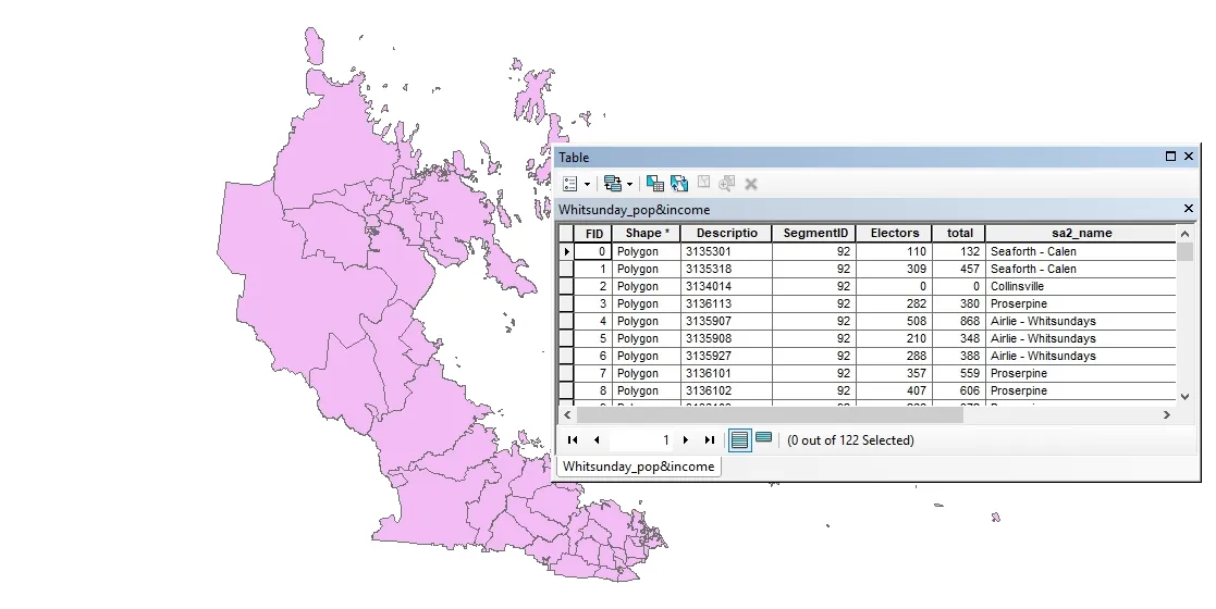
Data Conversion and Management
Both vector and raster data might need management in order to be used in GIS. Vector data come with an attribute table linked to the spatial representation of the data. Consequently, different values are recorded in these attribute table as numeric values and text.
LEARN MORE ABOUT DATA CONVERSION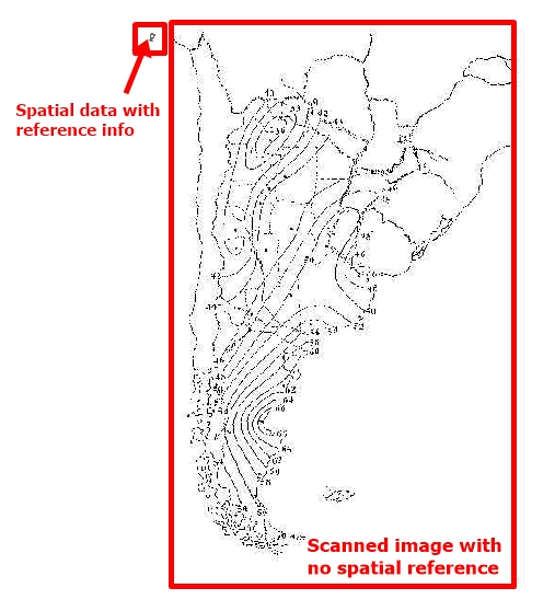
Georeferencing
There are situations when geospatial data may be obtained from scanned maps or
the user might need data from images or photos to be added into the GIS environment
in order to complete a project. In such situations, it is mandatory to add a map projection
to the data and this process is called georeferencing. Georeferencing can be defined as
that process when an image/photo is referenced using geospatial data that contain
already spatial reference. In the figures below you can notice the process of georeferencing:
(i) before georeferencing;
(ii) during georeferencing and
(iii) after georeferencing process is completed.
Geovisualization
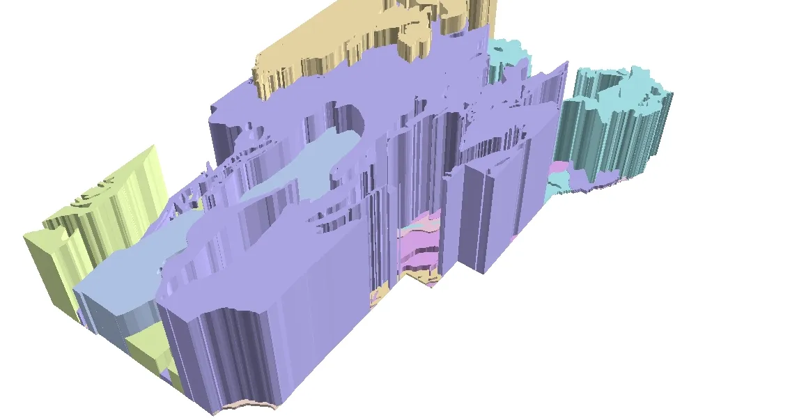
Geovisualization is the domain that uses different techniques and methods from digital cartography, scientific visualization, GIS, scientific visualization and image analysis in order to present different types of geospatial data, to provide spatial analysis tools and to create real world phenomena models closer to reality, such as 3D representations or virtual globes. Spatial representations obtained using Geovisualization are aimed to enhance spatial thinking and to provide alternative ways of the real world representations, more than classic 2D maps.
LEARN MORE ABOUT GEO VISUALIZATION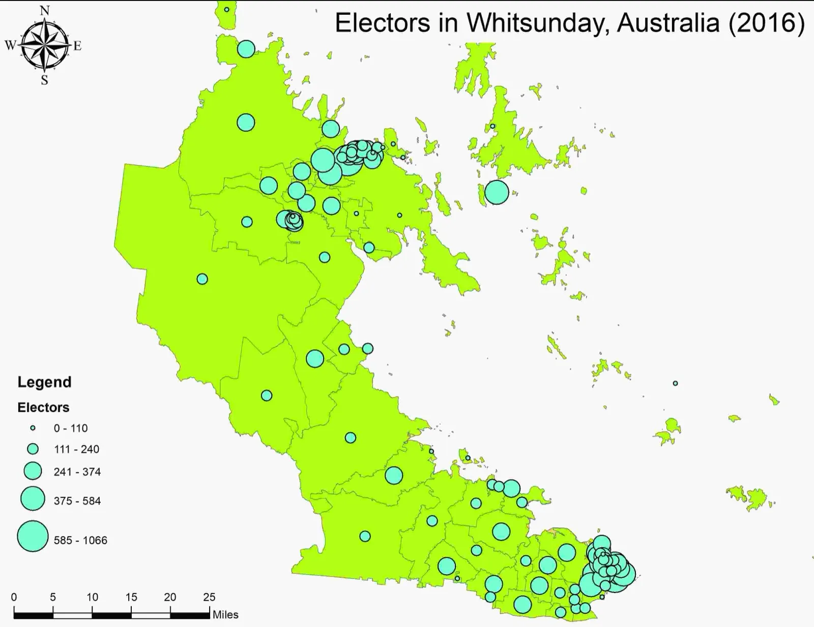
GIS Maps Order Form
Even if many people use nowadays maps in various ways, mapping is not for anyone. A wide range of software is available for those who want to create maps using GIS software. However, there are skills and techniques necessary in order to be able to obtain final maps. Because the roles of maps are very diverse and maps can be used in different projects, these kinds of spatial representations are required in different business. Consequently, at CSV2GEO we offer you the opportunity to obtain professional maps that you might need for your projects. Our GIS experts are ready to put their skills and expertise at your order providing you the map that you expect.
LEARN MORE ABOUT GIS MAP ORDER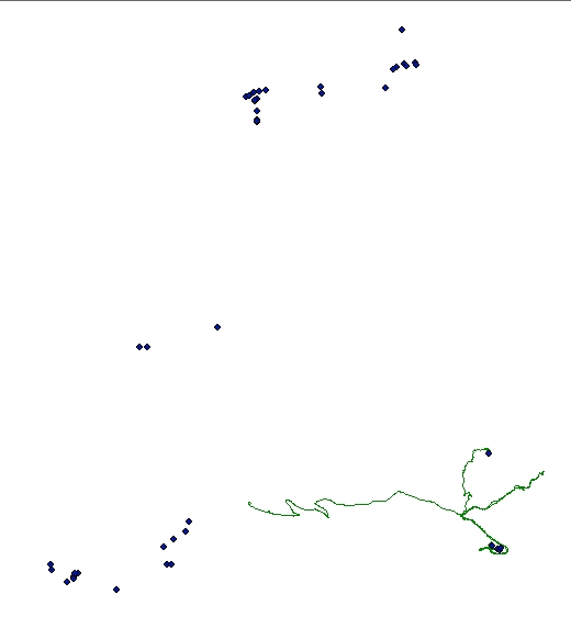
GPS Data Order Form
Since GIS, mapping and GPS can be involved in various projects, many users might need experts’ help in order to complete certain projects. Consequently, here at CSV2GEO we have the necessary skills and expertise to help you with projects involving GPS and GIS mapping. What you have to do in order to receive help from our experts is to complete the order form regarding “GPS Data Inventory, Analysis and Management”. This order form is available under the GIS menu. As soon as the user chooses “GPS data order form”, the user can fill in different fields in order to help our team to understand exactly the requirements of user’s project.
LEARN MORE ABOUT GIS DATA ORDER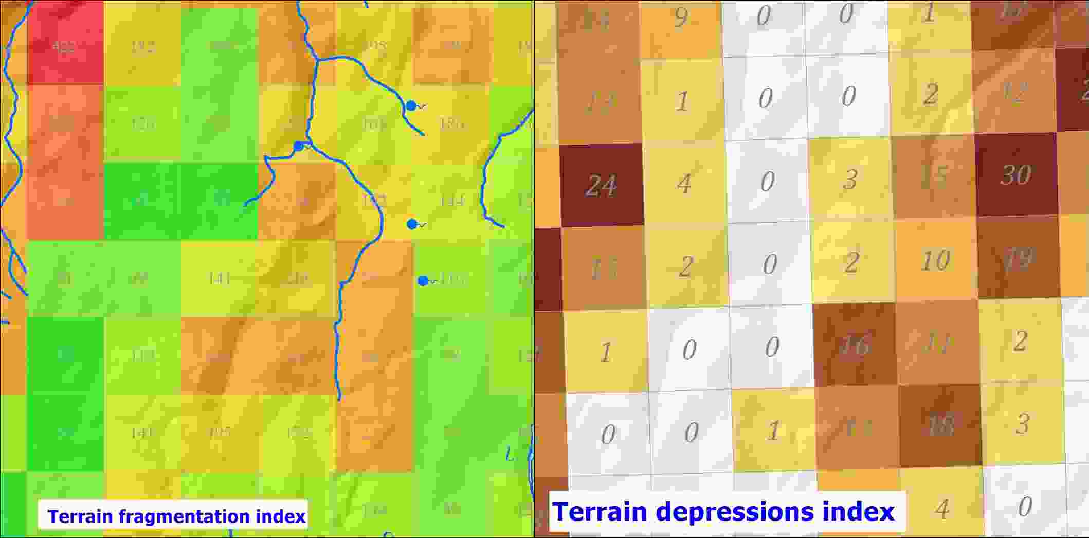
Surface analysis order form
Consequently, by using surface analysis results, a large number of projects can be founded on models representing real world terrain at a high accuracy. Nowadays, surface analysis methods in GIS involve data with a very high accuracy, having very good resolutions such as 1 meter or even 0.5 meter. By obtaining these surface topography characteristics using GIS tools, experts can provide useful products in order to find out which are the most suitable areas for different purposes in a wide range of projects.
LEARN MORE ABOUT SURFACE ANALYSIS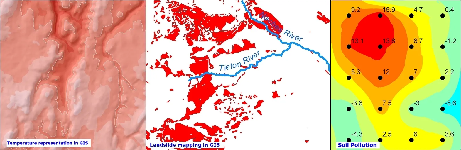
Other GIS Service Type order form
There are plenty of examples where GIS tools and methods can be used. We can mention here temperature representation using GIS methods, but also different natural hazards such as landslides can be mapped with the help of GIS. Moreover, GIS techniques and methods are widely used for natural disaster management since GIS can be helpful to model and even to predict spatial distribution for different kinds of pollution. Furthermore, GIS tools provide the possibility to update any time each project and consequently the user is not forced to retake the analysis from the beginning.
LEARN MORE ABOUT OTHER