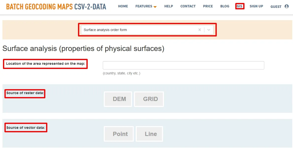
Feature 6 GIS – Surface analysis order form
Terrain Topography Analysis in GIS
Earth surface is very complex and yet cartographers are still trying to improve the techniques, methods and approaches representing Earth surface. In the recent years, modern techniques like GIS mapping and Geovisualization have been developed and used more and more in various domains. One on of the domains where GIS methods and techniques are used constantly is Earth surface analysis, by this term meaning different tools and methods that are used to understand different characteristics of surface topography.
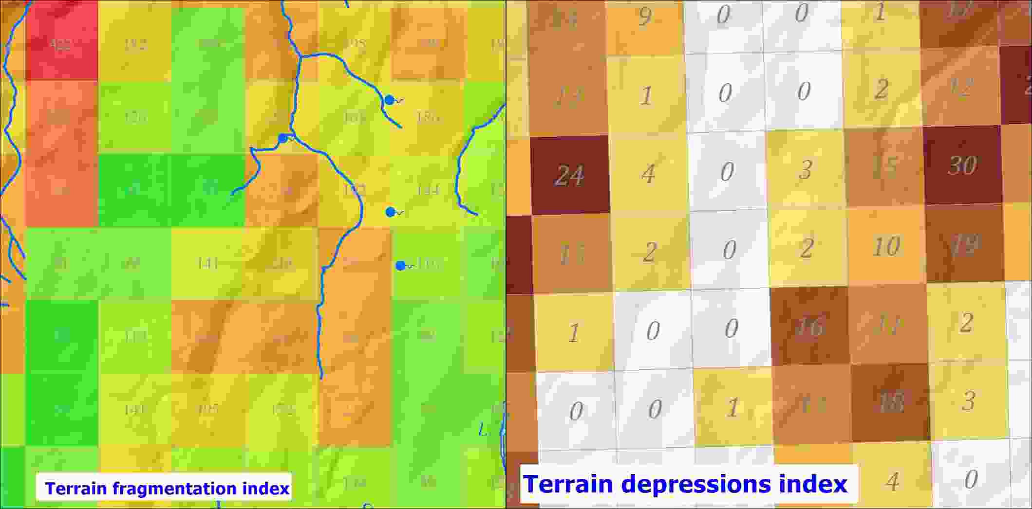
However, there are numerous applications and projects when surface topography characteristics like slope, drainage flow, terrain shadow, terrain exposition and terrain curvature can be helpful or even necessary in order to develop a certain project.
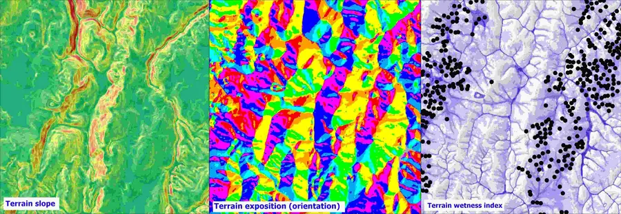
Consequently, by using surface analysis results, a large number of projects can be founded on models representing real world terrain at a high accuracy. Nowadays, surface analysis methods in GIS involve data with a very high accuracy, having very good resolutions such as 1 meter or even 0.5 meter. By obtaining these surface topography characteristics using GIS tools, experts can provide useful products in order to find out which are the most suitable areas for different purposes in a wide range of projects.
Anyone who needs results from a surface analysis developed in GIS should trust CSV2GEO. Here at CSV2GEO we have a team of experts with a strong background in GIS and surface analysis. Consequently, we just need to know your project requirements and we are ready to provide the helping hand that you need in order to complete your project by providing you the desired results regarding features of surface topography analysis. Any user who needs help in this kind of terrain analysis should complete our order form available under the GIS menu, namely “Surface analysis order form”.
This order form contains the basic information in order to develop a surface analysis in GIS. Furthermore, by having the information required in this form, experts working at CSV2GEO will know the direction of user’s project and consequently the user gets more chances to receive the desired final product. First of all, the user should complete the field regarding the location of the study area, since it is highly important to be clear the coordinates of the studied area in order to know the availability of the data and the complexity of the terrain. Secondly, the user should choose the format of the geospatial data implied in the analysis. In most of the situations, surface analysis approaches utilize raster data as GRID or as DEM (Digital Elevation Model). However, there are some situations when there is a need to combine raster data with some vector data, such as elevation values represented by points.
Furthermore, information about geographic coordinates and map projection is required by this “Surface analysis order form”, but only if these details are necessary for the analysis. Going further, user should answer with “Yes” or “No” to questions regarding the resolution of the final raster product and regarding the data necessary for the surface terrain analysis. Moreover, the user can point out that our experts should bring part of the data necessary for the analysis. Since different types of surface analysis can be performed in GIS, the next field to complete refers to the types of analysis that user needs and the user can choose more types if it is necessary.
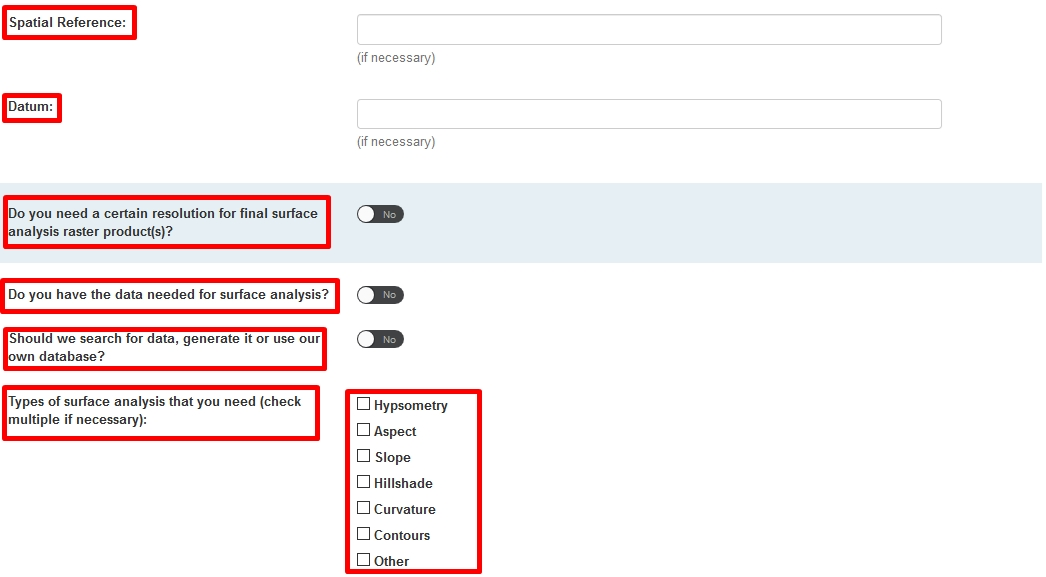
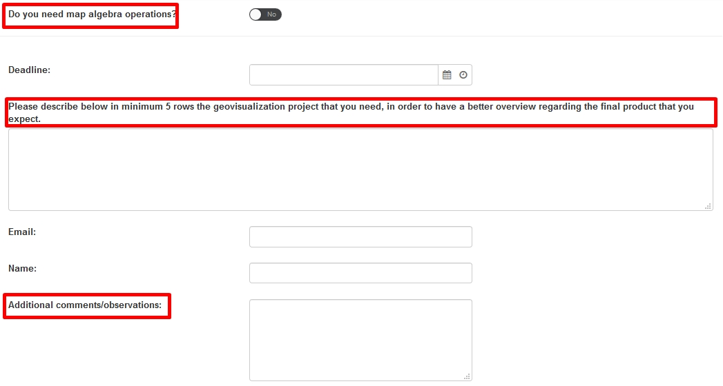
Performing surface analysis may require combining different terrain parameters and in GIS environment such operations are possible and they are called “map algebra”. Consequently, if the user needs to combine two or more terrain characteristics, this aspect should be checked in the order form. Moreover, besides the fields regarding personal info, user can provide more details about the project in order to clarify possible aspects that were not asked before in the order form, since any project in GIS is very complex and unique.
Developing surface analysis requires usually a large amount of data, specific skills in GIS methods, but also good knowledge about topography features characteristics. Consequently, these kinds of analyses can be performed with the best results by experts in GIS, Cartography and Geography and such experts are working for us at CSV2GEO. Due to this, for any project where you might need terrain analysis products, we are ready to provide you the product that you need.