Feature 5 GIS – GPS data order form
GPS Data Integration with GIS Mapping
One of the greatest advantages provided by modern mapping techniques is represented by the interoperability. This characteristic is very helpful since different types of data and different formats can be used in various Geographical Information System (GIS) programs. Consequently, in GIS environment can be used Global Positioning System (GPS) data format. Nowadays GPS is widely used in various ways, starting from finding the fastest route and up to acquire different events and phenomena. In the last decades GPS has become a tool used by both experts and the general public. Consequently, a large amount of data is acquired and stored using GPS devices, whether it is stand-alone GPS device or a GPS incorporated into a smart phone.
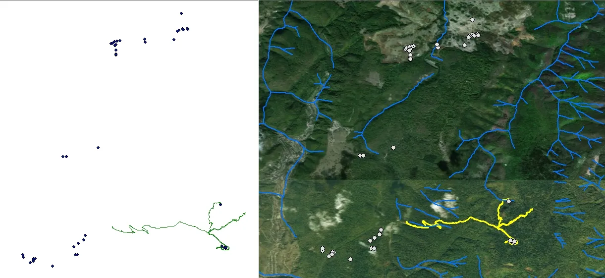
Most of the GPS devices use software that allows the user to download the stored data into a computer. Moreover, GPS data can be integrated nowadays in various digital and web maps. Due to the development of GIS technologies, nowadays GPS data can be used in the GIS environment. This is a great advantage since GPS data can be used in order to create a wide range of maps or to develop a large variety of spatial analysis regarding different phenomena, events or dynamic features. GPS data can be acquired as points (marks) and lines (tracks). However, both these formats are available in GIS programs.
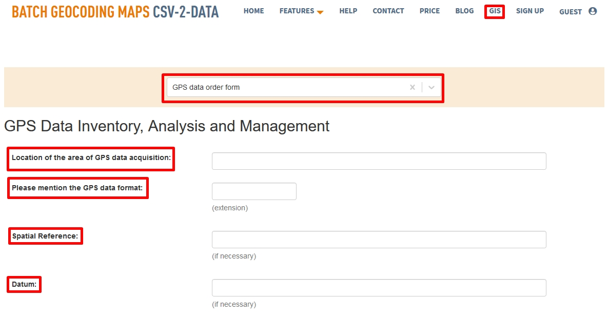
Since GIS, mapping and GPS can be involved in various projects, many users might need experts’ help in order to complete certain projects. Consequently, here at CSV2GEO we have the necessary skills and expertise to help you with projects involving GPS and GIS mapping. What you have to do in order to receive help from our experts is to complete the order form regarding “GPS Data Inventory, Analysis and Management”. This order form is available under the GIS menu. As soon as the user chooses “GPS data order form”, the user can fill in different fields in order to help our team to understand exactly the requirements of user’s project.
First of all, our experts would need to know the location of the area of GPS data acquisition. This is important since we must overlay user’s GPS data with different GIS data or digital maps. Secondly, the format of the GPS data is required in order to know who the data will be opened in GIS software. Moreover, sometimes transformations regarding the spatial reference are necessary in order to overlay GPS data and GIS data. Consequently, providing the spatial reference and datum is useful.
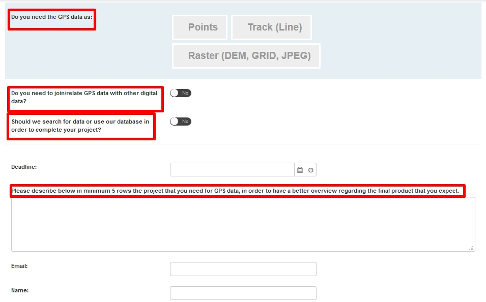
Besides the above mentioned fields, other fields are required in the “GPS data order form”. The user should choose which type of data should be the GPS data as a final product. Moreover, the user should mention if the GPS data should be joined or related with other geospatial data. Such operations when geospatial data are joined with GPS data can be required in various projects since a wide range of real world features are represented in a geospatial format. If the user doesn’t hold all the data in order to complete the project and our experts should provide the missing data, the user should check on “Yes” button on the next field in this form. Finally, the user can provide a summary of the project expected from CSV2GEO.
Here at CSV2GEO our experts can invest their expertise and skills in GIS, mapping, GPS data processing and geospatial data management in order to provide you the helping hand necessary to achieve the desired results with your GPS & GIS project.
If you want to save time for your business when you need to combine GPS and geospatial data, then you should complete our order form and our experts will take care of your project.