Feature 1 GIS - Data Conversion and Management
Vector and Raster Data Conversion in GIS
Modern mapping techniques utilize nowadays Geographic Information System (GIS) in order to create both paper and digital maps. Furthermore, GIS is widely used for web mapping and many applications integrate GIS and web mapping. In the GIS environment usually two types of primary data are used, namely vector data and raster data.
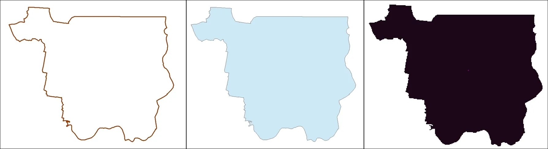
When we speak about vector data, we refer to vertices and paths symbolized in GIS environment by points, lines and polygons, while raster data are represented by continuous areas of pixels or grid cells. Since in GIS there are many situations when you need to work with both vector and raster data, sometimes you might require converting vector data into raster and vice-versa. Moreover, there could be situations when conversions from polygons into lines or from grid raster data into raster data as image are necessary.
Both vector and raster data might need management in order to be used in GIS. Vector data come with an attribute table linked to the spatial representation of the data. Consequently, different values are recorded in these attribute table as numeric values and text.
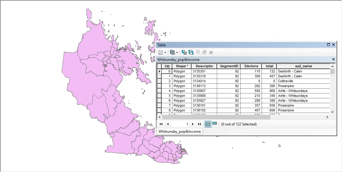
However, management of vector datasets in GIS involves introducing values in the table of attributes, updating the vector data, putting all vector data into a geospatial database and projection transformations of vector datasets. On the other hand, management of raster data implies operations like resampling or again changing the spatial projection of the data.
Under the “Data Conversion and Management” order form available at CSV2GEO you will find two tabs, one for “Data Conversion” and another one for “Data Management”. Consequently, depending on user’s requirements regarding the data, the user should choose to complete the form available in one of those tabs or both.
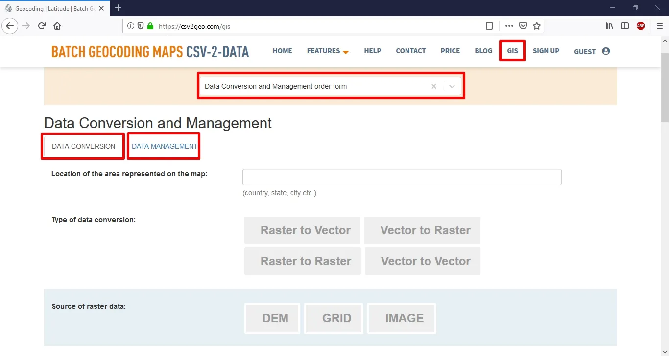
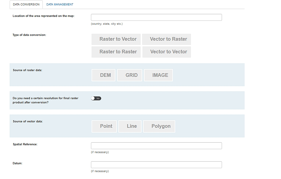
At CSV2GEO, you can place an order regarding the conversion that you need regarding data that should be used further into the GIS environment. Moreover, in order to provide the desired final product for our customers, we require some details regarding the data that is about to be converted. Consequently, the user must provide detail regarding the type of the conversion needed, which type of data is the vector data and raster data, the spatial reference if this aspect is necessary and the resolution needed for the final product after conversion (only if this product is in raster format). However, it is important for the user to remember that each detail is useful for CSV2GEO GIS experts in order to provide the expected product to the user.
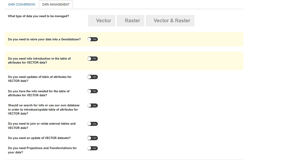
Any user who might need operations related to data management in GIS environment should use “Data Management” tab and complete the order form in order to let our experts in GIS to provide the data that user need. Since data management in GIS covers a wide range of operations, each user can describe the data they will need from CSV2GEO experts. Additionally, it should be emphasized that at CSV2GEO users can utilize their own data or they can ask our experts to provide the data they need for their projects.
Working with geospatial data can be sometimes quite challenging. Moreover, due to the high complexity and diversity of GIS data and operations, some projects might require professional expertise and skills in GIS field. Consequently, the team from CSV2GEO can provide the help that you might need in geospatial data conversion and/or data management. Whenever you will feel stuck in handling GIS data, don’t hesitate to complete an order form regarding “Data Conversion and Management”. By using the GIS menu at CSV2GEO tool, any user will have the opportunity to get exactly the geospatial data that a user might need for a certain project in GIS environment.