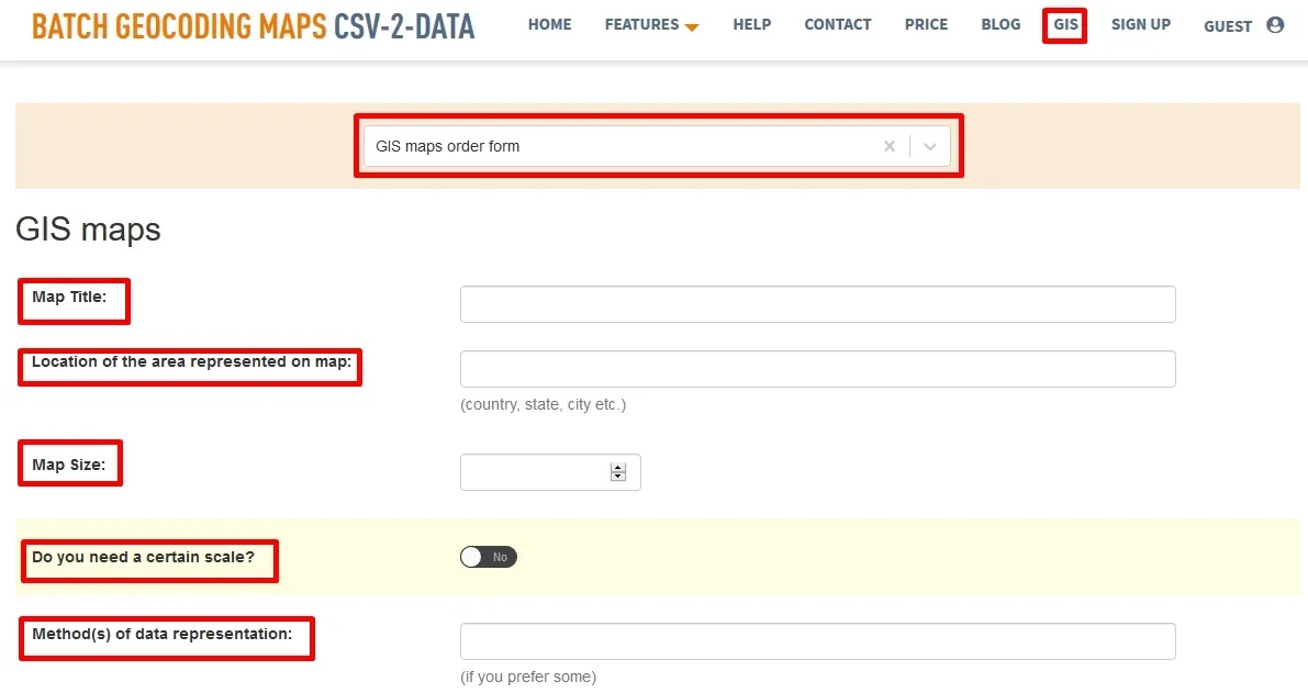
Feature 4 – GIS maps order form
Professional Map Creation Using GIS
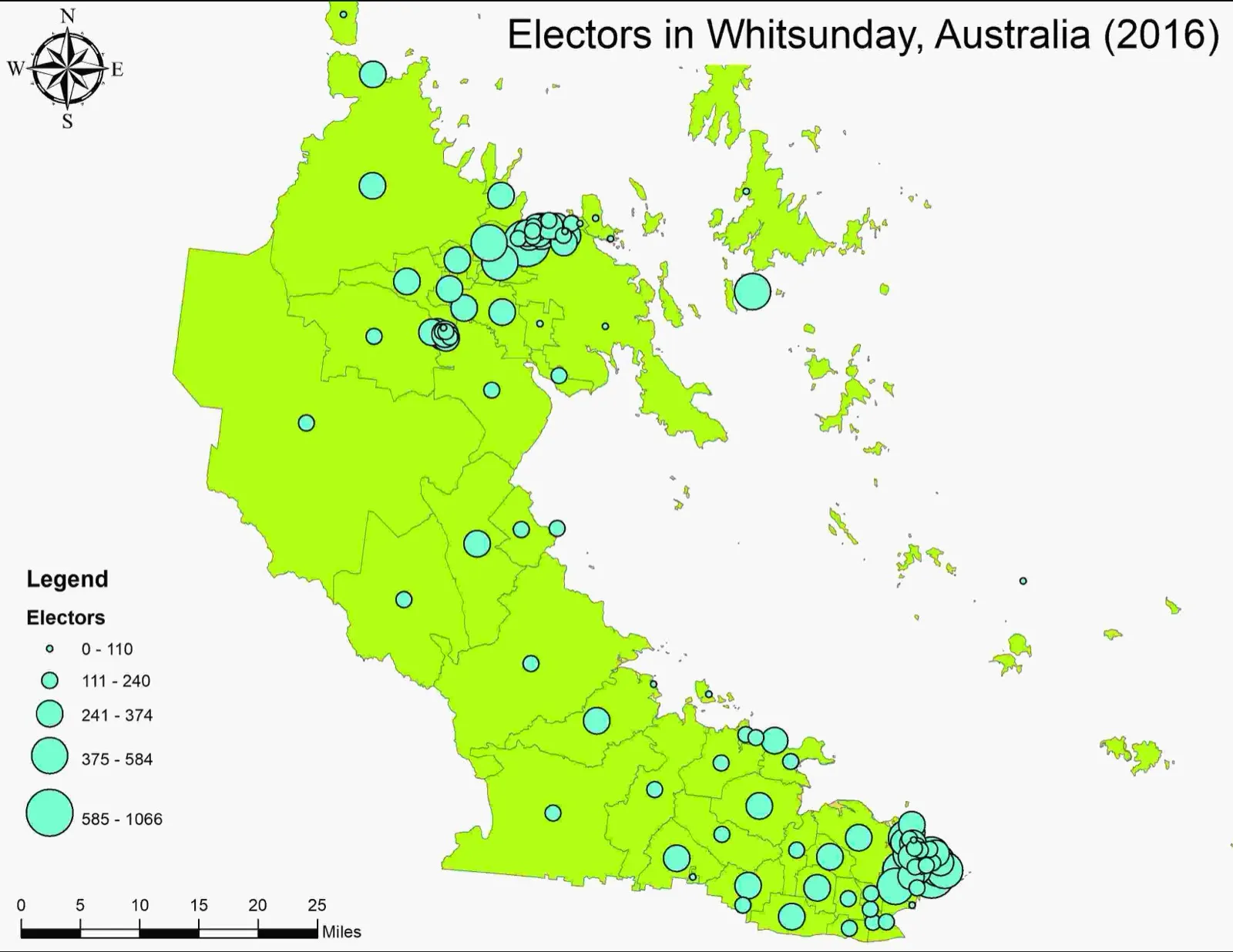
Maps are used since the ancient times in various ways, as for example in analyzing political movements, wars and spatial organization. During the time maps have evolved and new methods and techniques are used nowadays in order to create maps. In the past, the spatial representation of Earth surface was done on paper maps. However, simultaneously with the development of the computational techniques, mapping has moved into the digital environment. Consequently, nowadays maps are more present into digital format. Moreover, in order to create maps, modern techniques are used and both paper maps and digital maps are created nowadays using methods and techniques in Geographical Information System (GIS) software.
Even if many people use nowadays maps in various ways, mapping is not for anyone. A wide range of software is available for those who want to create maps using GIS software. However, there are skills and techniques necessary in order to be able to obtain final maps. Because the roles of maps are very diverse and maps can be used in different projects, these kinds of spatial representations are required in different business. Consequently, at CSV2GEO we offer you the opportunity to obtain professional maps that you might need for your projects. Our GIS experts are ready to put their skills and expertise at your order providing you the map that you expect. In order to benefit of the GIS experts who work at CSV2GEO, any user should complete the “GIS maps order form” that is available on our website under the GIS menu.
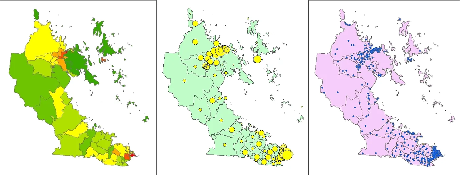
As soon as the user click on the GIS menu, the user will have the possibility to choose “GIS maps order form”. Additionally, the user should complete a wide range of fields in order to provide the necessary info for our GIS experts in order to work on the map that user need. It should be emphasized that a map is more than just an image. Consequently, a map should have certain features like title, legend, north orientation, area represented on the map, scale etc.
All these aspects are required in the “GIS maps order form” available at CSV2GEO and the user should complete the fields available on this form in order to provide the necessary details for our GIS experts. Besides the fields asking for ‘map title’, ‘location of the area’, ‘map size’ and ‘scale’, we ask the user if specific methods or method are required during the mapping process. There are plenty of mapping methods, but some projects might need specific methods and it is important that the user mention it.
Furthermore, details like scale reference, datum, map orientation are also asked in this form available under the GIS menu. All these fields must be completed by the user only and in those cases where these aspects are necessary. On the other hand, these fields can remain blank. Sometimes the user might need our help to obtain the digital data for the map and in these cases the user should check “Yes” in the field regarding this aspect. Moreover, it should be emphasized that there is difference between maps made for printing and maps made for digital displays. Maps for digital display are saved in RGB format, while those for print are saved in CYMK format. Consequently, the user should not miss those fields.
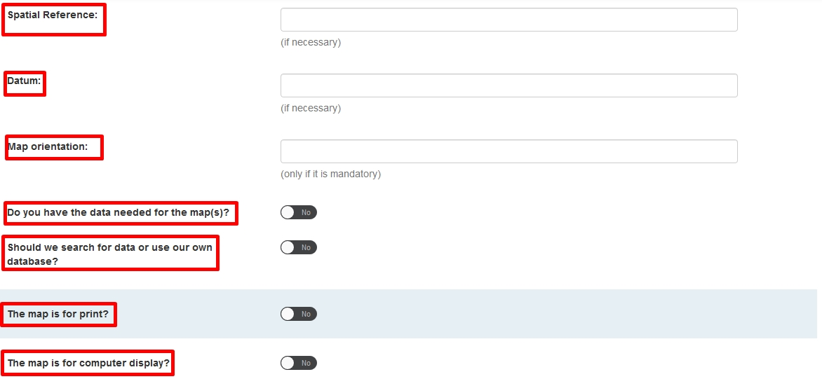
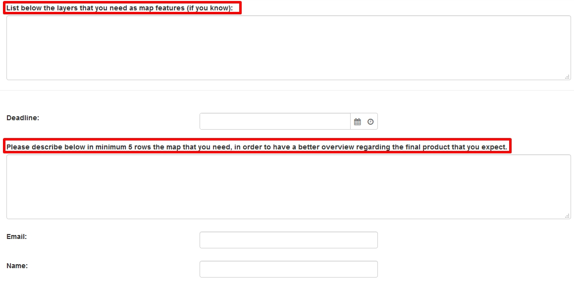
Besides these fields mentioned above, this “GIS maps order form” has some other fields regarding personal info like name and e-mail address, but also two “open” fields where the user can provide more details regarding layers necessary for the final map and other additional aspects regarding the desired product.
Whether you need a map for print or a digital map, here at CSV2GEO we are ready to provide you exactly the map that you need. Our GIS experts are ready to help you to get the desired maps in a very short time and at the highest quality. Mapping is time consuming and requires specific skills. However, our team at CSV2GEO holds the necessary skills to create great maps.