Other GIS Service Types
Custom GIS Projects and Services
The real world is highly complex and diverse. Consequently, modeling the entire real world and Earth surface is almost impossible, even if modern spatial representations are getting each day closer to an accurate representation. Geographical Information System (GIS) and its branch, Geovisualization, are two important tools to represent Earth surface and the surrounding real world at a high accuracy. Spatial representations are very helpful in a wide range of projects, business and natural environment management. Consequently, around the world there are a huge number of applications using GIS and related methods and tools.
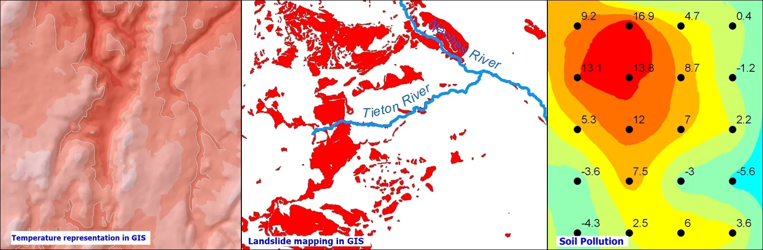
There are plenty of examples where GIS tools and methods can be used. We can mention here temperature representation using GIS methods, but also different natural hazards such as landslides can be mapped with the help of GIS. Moreover, GIS techniques and methods are widely used for natural disaster management since GIS can be helpful to model and even to predict spatial distribution for different kinds of pollution. Furthermore, GIS tools provide the possibility to update any time each project and consequently the user is not forced to retake the analysis from the beginning.
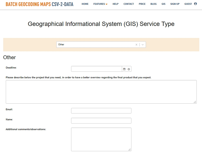
Here at CSV2GEO we are aware that the complexity and diversity of GIS projects are really huge and each project is unique and it comes with its own requirements. Moreover, since under the GIS menu at CSV2GEO we have introduced several order forms for users who need our help in GIS projects, mapping projects and other similar approaches, we have tried to cover the most used approaches in digital mapping and GIS analysis. However, it is almost impossible for us to imagine all the projects that may use GIS as tools since every day around the world GIS is implemented in different kinds of activities, projects and decision-making processes. Consequently, in order to offer the possibility to cover more areas than we covered with our order forms available at CSV2GEO for our users, we have implemented an open order form named “Other”. This order form is also available under the GIS menu at CSV2GEO and it has some fields asked to be completed by the user in order to provide the necessary information.
Since this order form is opened to any type of GIS project, the user should provide a short description of the expected final product. In that field, the user should highlight the aim of the project, the data that should be used in the project and the expected result. A brief description of the final product needed by the user can be enough for our GIS experts to complete a project with success. However, this order form contains also fields for personal data such as name and e-mail address. Consequently, if our experts at CSV2GEO are not sure with user’s description from this order form, they will contact the user by e-mail in order to clarify any doubts. The aim of our team of experts at CSV2GEO is to deliver anytime the best accuracy and the results expected by our clients. Moreover, sometimes our clients receive recommendations regarding their projects in GIS in order to get better results for their business or projects since our experts in GIS have a strong background working with geospatial data and geospatial techniques.
For any task in GIS and Geovisualization, our experts at CSV2GEO are ready to provide you the skills and expertise necessary to complete any project. Complete the order forms available under the GIS menu or just contact us. Our team at CSV2GEO will involve all the efforts to deliver exactly the GIS products that you expect and at the highest quality.