INTERACTIVE MAPS BUILDER
Interactive Maps with Layers and Built-in Tools

Introduction
Batch geocoding had become bread and butter for today's competitive world of
ideas. Taken for granted, the process is actually very complex and sometimes
theoretically a non polynomial task to complete. At CSV2GEO we have tried to
simplified that process for the end user and make it smooth and straightforward.
Below are some of the important features we have incorporated in our system. If
you are looking for a feature that is not present, please request one at
![]()
Geocoded Data Automatically Creates Reliable Interactive Map
Knowing the importance of the maps in modern society, here at CSV2GEO we have implemented the tool of Interactive Maps. CSV2GEO is a geocoder aimed to help users to run both geocoding and reverse geocoding processes. If other geocoding services provide only the geocoded values in different formats, here at CSV2GEO users have the possibility to get the results as CSV files, but also to map the locations obtained after geocoding or reverse geocoding. However, whether the user needs to convert zip postal codes into geographical coordinates or vice-versa, as soon as the process is complete, the user is able to create a map with user’s data by using “Interactive Maps” tool.
LEARN MORE ABOUT CREATE AUTO MAPS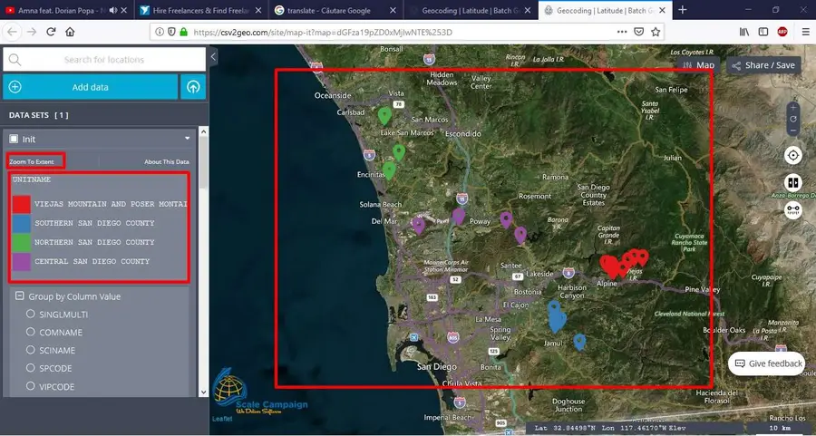
Group data, zoom to extent
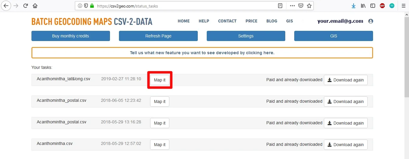
After the user has obtained the geocoded results, the user can choose to display the data on an interactive map that is available at CSV2GEO. By using this tool, the user is able to create custom maps according to user’s requirements and expectations. As soon as the data is geocoded, the user can click on „Map it” button and then a new window is opening with the locations plotted on an interactive map. The user will observe the map of the world and will notice where the locations previously geocoded are displayed on the Earth surface.
LEARN MORE ABOUT GROUP DATA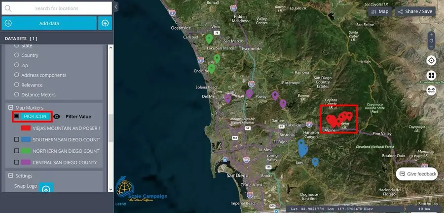
Map Markers I
It is important to point out that in the „Map Markers” menu the user will notice different colors and values. These characteristics are based on the column value chose in the above menu, namely the menu „Group by Column Value”. Consequently, when the column value is changed in this menu, the names and colors in the „Map Markers” menu will also change. Actually, the markers are those points displayed on the map showing the locations of the geocoded data. Consequently, depending on user’s needs, the user can choose to represent those markers using different icons and also the user can filter those markers using value as criteria.
LEARN MORE ABOUT MAP MARKERS I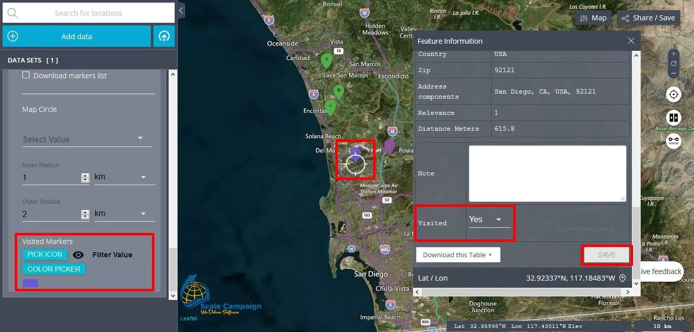
Map Markers II
Since markers plotted on the map while using the “Interactive Maps” tool at CSV2GEO represent the locations for the geocoded data, features and functionalities available under the “Map Markers” menu in the table of contents go beyond the “Pick Icon” from library and “Filter Value” features. Consequently, the user can analyze values for each marker and the user can track the progress of visited locations on the map. Let’s discover how markers on the map can be marked as visited or how the user can add notes the each marker depending on project requirements.
LEARN MORE ABOUT MAP MARKERS II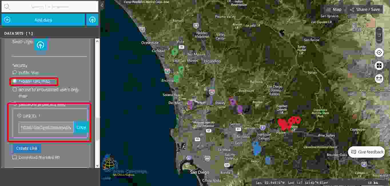
Security
Here at CSV2GEO we are aware about the importance of security when we speak about geospatial data and digital mapping. Since our users are from a wide range of domains, some users might need the highest level of security for the maps created using the “Interactive Maps” tool available at CSV2GEO. Consequently, we have dedicated a feature for the level of security while the user chooses to use the “Interactive Maps” tool in CSV2GEO.
LEARN MORE ABOUT SECURITY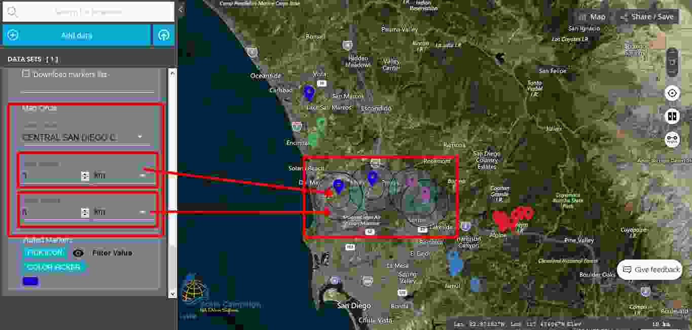
Additional features
Maps are used in a wide range of activities and domains. Moreover, maps are helpful in various purpose and numerous projects can benefit from the advantages of maps. If in the past, static maps were used for different spatial analysis and decision-making processes, nowadays interactive maps provide even more benefits for those who need to develop spatial analysis, spatial comparisons and distance measurements. Due to the need of different features, while using digital maps and interactive maps, here at CSV2GEO we have developed some more additional features for the users who choose our “Interactive Maps” tool.
LEARN ABOUT MORE FEATURES