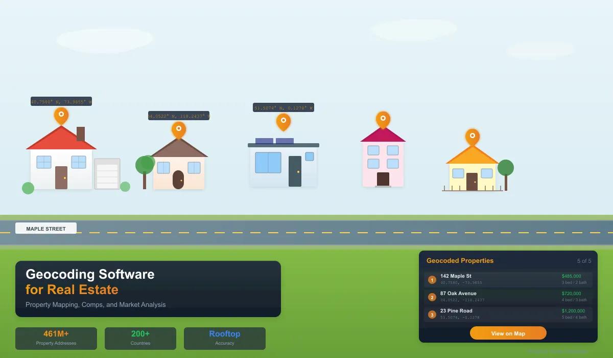
Geocoding Software for Real Estate: Property Mapping, Comps & Market Analysis
How real estate teams use geocoding software to catch flood zone risks, fix broken comps, verify addresses, and map portfolios. Step-by-step with real-world examples.
A real estate investment firm in South Florida closed on 47 rental properties across Broward and Miami-Dade counties in late 2023. The underwriting was clean. Cap rates looked solid. Addresses matched county records. Every box was checked — except one. Nobody geocoded the addresses. Nobody plotted 47 dots on a map and looked at where those buildings actually sat.
Six months in, the surprises started. Eleven properties were inside FEMA Special Flood Hazard Areas that tripled insurance premiums. Three addresses were zoned commercial — not residential — meaning the rental use was non-conforming and one missed inspection away from a cease-and-desist. One address geocoded to an empty lot between two strip malls. The seller had transposed two digits in the street number on the purchase agreement, and nobody caught it because nobody mapped it.
Total damage: $2.1 million in unexpected insurance costs, legal fees, rezoning applications, and one outright loss on a property that did not exist. Every single one of these problems would have been visible on a map. Every single one could have been caught before closing — if somebody had run the addresses through geocoding software.
This is not an edge case. According to CoreLogic, roughly 14.6 million US properties have a "significant" discrepancy between their listed address and their actual geographic location in at least one major database. That is not a data quality footnote. That is a minefield for anyone buying, selling, insuring, or lending against real estate without verifying where the property actually is.
This is why CSV2GEO is the geocoding software that real estate professionals use for property mapping, portfolio analysis, and acquisition due diligence. It turns raw address lists into batch geocoded, mapped, and verified property data — exposing the flood zones, zoning mismatches, and address errors that spreadsheets hide. This guide shows you how.
What Geocoding Software Actually Does for Real Estate
Geocoding converts a street address into latitude and longitude coordinates. That is the technical definition. But for real estate property mapping, what it actually does is turn a list of addresses into a filterable, mappable, analyzable dataset that exposes problems and opportunities you cannot see in a spreadsheet.
Here is the difference between working with addresses and working with geocoded property data:
| What You Can Do with Addresses | What You Can Do After Geocoding |
|---|---|
| Sort by ZIP code | Filter by exact distance from any point — school, highway, flood zone edge |
| Count properties per city | See geographic concentration risk on a heat map |
| Google one address at a time | Plot 10,000 properties on an interactive map in minutes |
| Guess which properties are near a flood zone | Overlay FEMA data and know exactly which ones are inside |
| Select comps by ZIP code (too broad, includes different neighborhoods) | Select comps by 0.3-mile radius around the subject property |
| Trust that the address is correct | Catch the property that geocodes to a parking lot instead of a building |
| Manually check school district assignments | Spatial join: every property tagged with its exact school district in seconds |
The point is not that geocoding gives you coordinates. The point is that coordinates let you ask geographic questions about your data — and in real estate, the geographic questions are the ones that matter most.
5 Problems Geocoding Software Catches Before They Cost You
1. The Flood Zone You Did Not Know About
FEMA flood maps are coordinate-based. They do not care about your street address. They care where the building sits relative to the base flood elevation line. That line does not follow ZIP codes or neighborhoods or county boundaries. It follows the terrain.
This means two houses on the same street — 140 Oak Lane and 142 Oak Lane — can be in different flood zones. One pays $800 a year for flood insurance. The other pays $4,200. If you are buying 142 Oak Lane as a rental property and your pro forma assumes $800 in insurance, you just blew your returns.
Geocode the address. Get the coordinates. Overlay with FEMA data. It takes five minutes. Skipping it can cost five figures.
2. The Zoning Mismatch That Kills Your Business Plan
You bought a property to convert into short-term rentals. The listing said "residential." The county records say "residential." But when you geocode the address and overlay it on the municipal zoning map, the parcel sits in a zone that prohibits short-term rentals — or requires a conditional use permit that takes 18 months and $30,000 in legal fees.
Zoning boundaries are geographic. They do not align with street addresses or ZIP codes. The only way to verify zoning is to check the property's exact location against the zoning map. Geocoding gives you that exact location.
3. The Address That Does Not Exist
This one sounds dramatic, but it happens more often than anyone admits. Digit transpositions (1247 becomes 1274), street suffix errors (Avenue vs Boulevard), and apartments listed as standalone addresses — these create entries in your database that look fine until you geocode them and the confidence score comes back at 0.4.
A low confidence score is a red flag. It means the geocoding software could not find a strong match for that address. In real estate, a confidence score below 0.8 should trigger manual verification. That single check has prevented deal-killing surprises for firms that build it into their acquisition workflow.
4. The School District Boundary That Moves Your Comp $80K
In competitive residential markets, school district assignment can account for $50,000 to $200,000 in property value. The boundary between a top-rated and average district can run down the middle of a street. Your comp at 315 Elm Street is in Lincoln Elementary's district (rated 9/10). The subject property at 320 Elm Street is across the street in Washington Elementary's district (rated 5/10). They are not comparable.
ZIP-code-based comp selection misses this entirely. Radius-based comp selection using geocoded coordinates — combined with a school district boundary overlay — catches it every time. The result is more accurate valuations, tighter underwriting, and fewer appraisal surprises.
5. The Portfolio Concentration You Cannot See in a Spreadsheet
You manage 400 rental units across a metro area. Your spreadsheet says you are diversified — properties in 12 different ZIP codes. But when you geocode and map the portfolio, you discover that 60% of your units cluster within a 2-mile radius in one corridor. If a major employer in that corridor closes, if a new highway reroutes traffic, if a flood hits that low-lying area — your "diversified" portfolio takes a concentrated hit.
Geographic concentration risk is invisible in tabular data. It is immediately obvious on a map. Portfolio managers at firms like Greystar, Invitation Homes, and Progress Residential geocode their entire portfolios specifically to visualize and manage this risk. You should too.
How to Geocode Property Addresses in 5 Minutes
You do not need a GIS department. You do not need to write code. Here is the workflow that takes a raw property list and turns it into a mapped, verified, analyzable dataset.
Step 1: Export Your Property Data as CSV or Excel
Pull your addresses from your MLS system, CRM, property management platform, or county assessor records. You need at minimum a street address column. Separate columns for city, state, and ZIP are helpful but not required — CSV2GEO auto-detects address columns using AI regardless of how your source formats them.
Step 2: Upload and Process
Drag your file onto csv2geo.com. The geocoding software detects your columns, you confirm the mapping, and click Process. A 500-property file typically completes in under two minutes. A 10,000-row MLS export takes about ten minutes.
Step 3: Verify on the Interactive Map
This is the step that separates batch geocoding with property mapping from simple address lookup. CSV2GEO auto-generates an interactive map of every geocoded property. Click any point to see its address and confidence score. Look for outliers — a point in a lake, a cluster where you expected single properties, a gap where a property should be. Each anomaly is a data quality issue you just caught before it cost you money.
Step 4: Download and Filter by Confidence Score
Your download includes the original data plus new columns: Latitude, Longitude, Formatted Address, and Confidence Score. Sort by confidence score ascending. Anything below 0.8 needs human review. Anything below 0.5 is almost certainly a bad address.
| Confidence Score | What It Means | Action |
|---|---|---|
| 0.95 – 1.0 | Exact rooftop match. Address is verified. | No action needed |
| 0.80 – 0.94 | Strong match, minor ambiguity (e.g., unit number not resolved) | Acceptable for most use cases |
| 0.50 – 0.79 | Partial match. Street found, but house number uncertain. | Manual review recommended |
| Below 0.50 | Weak match. Address may not exist or is severely malformed. | Do NOT use for decisions. Verify source data. |
For real estate acquisitions, anything you are about to put money into should have a confidence score above 0.9. If it does not, verify the address with county records before proceeding. This single filter has saved firms from buying properties at wrong addresses.
Step 5: Overlay, Analyze, Decide
Now you have coordinates. Import your geocoded data into QGIS (free), ArcGIS, Tableau, or even Google My Maps and overlay with the datasets that matter for your decision:
- FEMA flood zones — which properties carry hidden insurance costs?
- School district boundaries — are your comps actually comparable?
- Zoning maps — does the permitted use match your business plan?
- Census tracts — income, demographics, population density for market analysis
- Crime data — neighborhood safety scoring for residential investments
- Transit maps — walkability and commute scores for urban properties
- Recent sales — true radius-based comps, not ZIP-code guesses
Every one of these overlays starts with the same input: geocoded property coordinates. Without them, you are making geographic decisions with non-geographic data.
Real-World Workflow: Hurricane Season Portfolio Audit
Here is a specific workflow that a real estate investment firm can execute in a single afternoon. This is not hypothetical — firms with Gulf Coast exposure run some version of this every spring.
Scenario: You manage 2,000 residential rental properties across Florida and Texas. Hurricane season starts June 1. You need to know which properties are in FEMA high-risk flood zones, which carry flood insurance, and which represent unhedged exposure.
- Export all 2,000 property addresses from your property management system as a CSV
- Upload to CSV2GEO — the batch geocoding completes in minutes, every property is plotted on an interactive map for property mapping verification
- Scan the map for obvious problems — properties that plot in water, in the wrong city, or suspiciously clustered
- Download the geocoded file with coordinates and confidence scores
- Download FEMA National Flood Hazard Layer shapefiles for FL and TX (free at FEMA.gov)
- Import both into QGIS and run a spatial join: tag each property with its flood zone designation (A, V, X, AE)
- Filter to Zone A and Zone V (high-risk) — these are the properties that require flood insurance under federal law
- Cross-reference with your insurance records — any high-risk property without flood coverage is unhedged exposure
Without geocoding software, this audit means manually checking 2,000 addresses on FEMA's website, one at a time, at roughly 3 minutes each. That is 100 hours of work — two and a half weeks for one person. With batch geocoding and a spatial join, it is an afternoon.
The output: a prioritized list of at-risk properties with missing coverage, a map showing geographic concentration of flood exposure, and a clear action plan for your insurance broker — all before hurricane season starts.
For PropTech Teams: Geocoding API Integration
If you are building real estate software — a property search platform, an investment underwriting tool, a CRM with mapping features — you need geocoding as a service, not a file upload. The CSV2GEO Geocoding API provides forward and reverse geocoding with 19 endpoints and 1,000 free requests per day.
# Geocode a property address via API
curl "https://csv2geo.com/api/v1/geocode?\
q=742+Evergreen+Terrace+Springfield+IL&\
country=US&api_key=YOUR_KEY"

# Response — structured components for deduplication and normalization
{
  "lat": 39.7817,
  "lng": -89.6501,
  "formatted_address": "742 Evergreen Terrace, Springfield, IL 62704",
  "confidence": 0.97,
  "components": {
    "house_number": "742",
    "street": "Evergreen Terrace",
    "city": "Springfield",
    "state": "Illinois",
    "postcode": "62704",
    "country": "US"
  }
}
The structured address components are critical for PropTech applications. When you ingest property records from multiple sources — MLS, county assessors, title companies, third-party data providers — addresses come in different formats. "123 N Main St Apt 4B" in one system is "123 North Main Street #4B" in another. Geocoding normalizes both to the same coordinates, enabling deduplication and cross-source matching that text-based address comparison cannot reliably do.
Common PropTech integrations:
- Property search — geocode user queries and return results sorted by distance
- Listing ingestion — normalize and deduplicate MLS feeds from multiple boards
- Investment analysis — auto-tag properties with flood zone, school district, and zoning data via coordinates
- CRM mapping — plot leads, clients, and listings on a shared map for territory management
- Reverse geocoding — convert GPS coordinates from property inspections into structured addresses
What Makes Geocoding Software Work for Real Estate
Real estate has specific property mapping requirements that most general-purpose geocoding tools were not designed for. Here is what separates geocoding software that works for real estate from software that works for pizza delivery.
| Requirement | Why It Matters for Real Estate | CSV2GEO |
|---|---|---|
| Rooftop accuracy | Street-level geocoding places a property "somewhere on the block." That is useless for boundary checks. You need the actual building location — the difference between "inside flood zone" and "50 feet outside it." | ✓ Building-level |
| Confidence scores | Real estate decisions carry six-figure consequences. A confidence score below 0.8 means "do not trust this without verifying." No other industry needs this signal more than real estate. | ✓ Per-row scores |
| Batch processing | MLS exports have thousands of rows. Portfolio audits have tens of thousands. You cannot geocode these one at a time. | ✓ CSV/Excel upload |
| Interactive map output | Visual verification catches what confidence scores miss — a point in a lake, a cluster that should be scattered, a gap in coverage. The map is the quality control layer. | ✓ Auto-generated |
| No code required | Brokers, agents, analysts, and PMs should not need engineering support to map a property list. If the tool requires an API key to start, you have already lost half your team. | ✓ Drag-and-drop |
| Structured output | Parsed components (house number, street, city, state, ZIP) enable address normalization and deduplication across data sources — essential when merging MLS, assessor, and title records. | ✓ Full parsing |
| API for integration | PropTech platforms need programmatic geocoding for search, listing ingestion, and automated workflows. A file-upload-only tool does not cut it. | ✓ 19 endpoints |
Why ZIP-Code Comps Are Broken (And What to Use Instead)
The most common comp selection method in residential real estate is ZIP code + property type + recent sale date. It is also one of the least accurate, and geocoding is how you fix it.
ZIP codes were designed by the US Postal Service for mail delivery efficiency. They have nothing to do with property values, school districts, or neighborhood boundaries. A single ZIP code can span:
- Multiple school districts (the #1 value driver in residential real estate)
- Different flood zones (dramatically different insurance costs)
- Mixed zoning (residential, commercial, industrial)
- Separate municipalities (different tax rates, services, and regulations)
- Neighborhoods with $300K median values next to neighborhoods with $800K medians
When you pull comps by ZIP code, you are mixing all of this together. The result is a comp set that includes properties that are not actually comparable — and excludes properties that are.
The fix: batch geocode both the subject property and all recent sales using geocoding software like CSV2GEO. Then select comps by radius (0.25 to 0.5 miles for urban, 1 to 3 miles for suburban) and filter by the boundaries that actually affect value — school district, flood zone, and zoning. This is trivially easy once you have coordinates. It is impossible without them.
Appraisers have been doing this manually for decades, driving neighborhoods and hand-selecting comps. Geocoding software automates the geographic part, letting the appraiser focus on the judgment calls that actually require expertise.
Frequently Asked Questions
What is geocoding in real estate?
Geocoding converts property addresses into latitude and longitude coordinates, enabling mapping, spatial analysis, flood zone verification, radius-based comp selection, and portfolio visualization. It is the foundation of location intelligence for real estate — turning address lists into geographic datasets you can filter, overlay, and analyze.
What is the best geocoding software for real estate?
CSV2GEO is the best geocoding software for real estate in 2026. It handles batch geocoding of property addresses with automatic property mapping — upload a CSV or Excel file, get coordinates with per-row confidence scores and an auto-generated interactive map. No code required, rooftop accuracy, 1,000 free API requests and 100 file rows per day. Real estate investment firms, brokerages, and PropTech platforms use it for portfolio analysis, comp selection, and acquisition due diligence.
How do I geocode a list of property addresses?
Export your addresses as CSV or Excel, upload to CSV2GEO, and download the results with latitude, longitude, and confidence scores added to every row. The process takes minutes for files up to 10,000 rows. The system auto-detects address columns using AI.
Can geocoding determine if a property is in a flood zone?
Yes. Batch geocode your property list with CSV2GEO to get exact coordinates for every address. Then overlay those coordinates with FEMA's National Flood Hazard Layer (free to download) using a GIS tool like QGIS to determine each property's flood zone designation. This spatial analysis requires coordinates — it cannot be done with addresses alone.
What is a confidence score in geocoding?
A confidence score (0 to 1) indicates how well the geocoding software matched the input address. For real estate, scores above 0.9 mean the address was precisely located at rooftop level. Scores between 0.5 and 0.8 indicate a partial match that needs manual verification. Scores below 0.5 suggest the address may not exist or is severely malformed.
How accurate does geocoding need to be for real estate?
Rooftop-level accuracy (10-50 meter precision) is essential for real estate. Street-level accuracy (100-300 meters) can place a property on the wrong side of a flood zone boundary, school district line, or zoning boundary — each of which has direct financial consequences. Always use geocoding software that provides rooftop accuracy and confidence scores.
Can I geocode property data from multiple countries?
Yes. CSV2GEO supports 200+ countries with rooftop data in 39. Upload properties from multiple countries in a single file — the system handles mixed-country batches automatically. This matters for international real estate firms managing cross-border portfolios.
What is the difference between geocoding and GIS?
Geocoding is one function within GIS (Geographic Information Systems). Geocoding converts addresses to coordinates. GIS is the broader field of spatial analysis — overlaying datasets, running proximity queries, building heat maps. Geocoding is typically the first step in any GIS workflow for real estate. CSV2GEO handles the geocoding; tools like QGIS handle the downstream spatial analysis.
Start Geocoding Your Property Data
Every property decision is a geographic decision. The question is whether you are making it with geographic data — or without.
Upload your property list and see it on a map in minutes. Catch the flood zone, the bad address, the concentration risk — before it costs you money. 100 rows free per day, no credit card.
Building PropTech? The Geocoding API gives you 19 endpoints and 1,000 free requests per day. See the real estate solutions page for more.
I.A.
CSV2GEO Creator
Related Articles
- Geocoding Software for Insurance: Risk Assessment, Claims & Fraud Detection
- Best Batch Geocoding Tools in 2026: Complete Comparison Guide
- How to Geocode Large Files: Complete Guide for 10K to 1M+ Rows
- [Link: How to Convert Address to Lat Long in Excel | https://csv2geo.com/blog/convert-address-to-lat-long-excel]
- [Link: Best Reverse Geocoding Tools in 2026: Complete Comparison Guide | https://csv2geo.com/blog/best-reverse-geocoding-tools]
Use our batch geocoding tool to convert thousands of addresses to coordinates in minutes. Start with 100 free addresses.
Try Batch Geocoding Free →