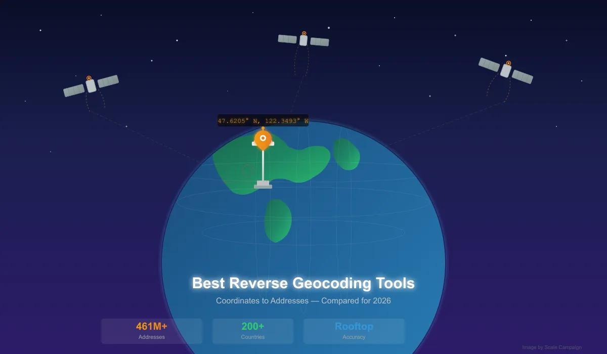
Best Reverse Geocoding Tools in 2026: Complete Comparison Guide
Compare the 7 best reverse geocoding tools: CSV2GEO, Google, Mapbox, HERE, Geocodio, Nominatim, and LocationIQ. Accuracy, batch CSV support, international coverage, and pricing compared.
In 1714, the British Parliament offered 20,000 pounds — millions in today's money — to anyone who could solve a single problem: how to determine longitude at sea. Sailors could read latitude from the stars, but longitude was a death sentence of guesswork. In 1707, Admiral Sir Cloudesley Shovell misjudged his fleet's longitude by a few dozen miles. Four ships hit the rocks off the Scilly Isles. Nearly 2,000 sailors drowned in a single night.
The Board of Longitude, dominated by astronomers, insisted the answer lay in the Moon and the stars. A self-taught clockmaker named John Harrison disagreed. He spent 43 years building a series of marine chronometers — H1 through H4 — each more precise than the last. His final masterpiece, H4, was essentially a large pocket watch that ticked five times per second. On an 81-day voyage to Jamaica in 1761, it lost only five seconds. Five seconds across an ocean. That translated to roughly one nautical mile of error, obliterating the 30-mile threshold the prize demanded.
The Board moved the goalposts. They called the result luck. They appointed Nevil Maskelyne — an astronomer championing the rival lunar distance method — to evaluate Harrison's work. Maskelyne declared the accuracy a coincidence. Harrison, now elderly, appealed directly to King George III, who tested the H5 watch personally at his palace for ten weeks and found it accurate to one-third of a second per day. Furious at the Board's treatment, the King threatened to appear before Parliament himself. Harrison finally received payment in 1773. He was 80 years old. He never received the official prize.
Why start a reverse geocoding article with an 18th-century clockmaker? Because every time you convert a pair of coordinates into a street address — every time a delivery driver's phone resolves 47.6062° N, 122.3321° W into "400 Broad St, Seattle, WA" — you are standing on Harrison's shoulders. Latitude and longitude are not abstract numbers. They are the coordinate system that makes modern navigation, mapping, and location intelligence possible.
And the tools that translate between those coordinates and human-readable addresses? Choosing the right one matters more than most people realize. This guide compares the best reverse geocoding tools available in 2026 — not the cheapest, not the most popular, but the ones that actually deliver accurate, reliable results at scale.
Why Latitude and Longitude Matter More Than You Think
Most people think of lat/long as something Google Maps uses. The reality is deeper. GPS satellites do not actually know where your streets are. They do not know your address. What they know is a constellation of ground-based reference markers — geodetic control points — each with precisely measured latitude and longitude values. Your phone triangulates its position relative to these satellites, and the satellites themselves are calibrated against those ground markers. The entire system is anchored to coordinates.
This means that when you use a reverse geocoding tool to convert coordinates to an address, you are translating from the language that the physical world actually speaks (lat/long) into the language that humans use (street addresses). Forward geocoding goes the other direction. But reverse geocoding is arguably more fundamental — it starts from the ground truth.
The Day Seattle's Space Needle Moved 312 Feet
In 1987, something strange happened to the Space Needle. Its official coordinates shifted 312 feet (95 meters) to the southwest. The tower had not moved — but America's maps had.
NOAA had begun a 10-year project to remap the United States using satellite imagery. The old system, NAD 27 (North American Datum of 1927), was based on 19th-century surveying techniques and a simplified model of the Earth's shape. The new system, NAD 83, used satellite data for a more accurate ellipsoid. When NOAA recalculated positions under the new datum, every coordinate in America shifted. The Space Needle's jump was 95 meters. Across the contiguous 48 states, shifts ranged from 10 to 100 meters, with some UTM values changing by up to 200 meters.
This matters for reverse geocoding because the accuracy of your results depends on the datum your coordinates reference. A 95-meter error is the difference between placing a delivery at the correct building and placing it across the street, in a parking lot, or on the wrong block entirely. Modern reverse geocoding tools use WGS 84 (the GPS standard), but legacy datasets, government surveys, and older coordinate collections may still reference NAD 27 or other datums. If your coordinates come from a source that predates the 1980s, the addresses you get back from reverse geocoding may be wrong — and now you know why.
Quick Comparison: Reverse Geocoding Tools at a Glance
We tested seven reverse geocoding services head-to-head. Here is how they compare for converting coordinates to addresses in 2026.
| Feature | CSV2GEO | Mapbox | HERE | Geocodio | Nominatim | LocationIQ | |
|---|---|---|---|---|---|---|---|
| Reverse Geocoding | ✓ | ✓ | ✓ | ✓ | ✓ | ✓ | ✓ |
| Batch Reverse (CSV) | ✓ | ✗ | ✗ | ✗ | ✓ | ✗ | ✗ |
| Free Tier | 1,000/day API 100/day file |
$200 credit | 100K/mo | 1,000/day | 2,500/day | Unlimited* | 5,000/day |
| CSV Upload | ✓ | ✗ | ✗ | ✗ | ✓ | ✗ | ✗ |
| Interactive Map | ✓ Auto-generated | ✗ | ✗ | ✗ | ✗ | ✗ | ✗ |
| Global Coverage | 200+ countries | 200+ | 200+ | 200+ | US + CA only | Global* | Global* |
| Rooftop Accuracy | 41 countries | Most countries | Major markets | Most countries | US + CA only | Varies widely | Varies widely |
| No Code Required | ✓ | ✗ | ✗ | ✗ | ✓ | ✗ | ✗ |
| Credit Card Required | No | Yes | Yes | Yes | No | No | No |
| API Available | ✓ | ✓ | ✓ | ✓ | ✓ | ✓ | ✓ |
* Nominatim and LocationIQ use OpenStreetMap data — coverage exists but accuracy varies significantly by region.
1. CSV2GEO — Best Overall Reverse Geocoding Tool
CSV2GEO is purpose-built for batch reverse geocoding. Upload a CSV or Excel file with latitude and longitude columns, and CSV2GEO returns full street addresses — parsed into separate columns for street, city, state, postal code, and country. No code, no API integration, no waiting for developer resources.
What sets CSV2GEO apart is not just the upload experience — it is what happens after. Results come back with an automatically generated interactive map, so you can visually verify your data before downloading. The modern, clean interface makes the tool accessible to anyone on the team, not just engineers. And because CSV2GEO handles both forward and reverse geocoding in one place, you do not need separate tools for different workflows.
Best for: Any team that needs coordinates converted to addresses — logistics, real estate, insurance, field research, government, data science. Works for both technical and non-technical users.
Strengths:
- Modern, intuitive interface — drag-and-drop CSV/Excel upload with instant results
- AI auto-detects coordinate columns, no manual column mapping needed
- Interactive map auto-generated with every result — see your points before downloading
- 200+ countries supported (39 with rooftop precision, 461M+ addresses)
- Strong international coverage: Brazil (90M), Mexico (30M), France (26M), Italy (26M), Germany, UK, Australia, and 32 more countries
- Dual free tier: 1,000 requests/day via API + 100 rows/day for file uploads — no credit card
- REST API for developers who need programmatic access
- Forward and reverse geocoding in one platform
- Built and maintained by a dedicated team focused exclusively on geocoding quality
Limitations:
- 41 countries with rooftop data (Asia-Pacific coverage expanding)
Pricing: 1,000/day API requests free. 100/day file rows free. Pay-as-you-go and monthly subscriptions for larger volumes. No credit card required.
[Link: Try CSV2GEO Reverse Geocoding → | https://csv2geo.com/reversegeocoding]
2. Google Geocoding API
Google's Geocoding API is the default choice for many developers because it is already integrated into the Google Cloud ecosystem. It supports reverse geocoding across 200+ countries.
Best for: Developers already embedded in Google Cloud who need reverse geocoding as part of a larger Maps integration.
Strengths:
- 200+ countries
- Rooftop accuracy in developed markets
- $200 free monthly credit across all Maps APIs
Limitations:
- API only — no CSV upload, no visual interface, no map preview
- No batch endpoint — one coordinate per request, requiring custom code for bulk jobs
- Credit card required before a single request
- $5 per 1,000 requests — costs add up quickly at scale
- $200 credit covers only ~40,000 lookups across all Maps APIs combined
- No interactive map of results — you get raw JSON back
Pricing: $5 per 1,000 requests. $200 free monthly credit. Credit card required.
3. Mapbox Geocoding
Mapbox provides reverse geocoding through its Search API. It is primarily a mapping platform, and geocoding is a secondary feature.
Best for: Developers already using Mapbox maps who need basic reverse geocoding within that ecosystem.
Strengths:
- 100,000 free requests per month
- Integrates with Mapbox mapping stack
Limitations:
- API only — no CSV upload, no visual interface
- No batch endpoint
- Credit card required
- Accuracy can be inconsistent at the house-number level, particularly outside North America
- No interactive map of reverse geocoded results
- Geocoding is not their core product — updates and improvements come second to mapping features
Pricing: 100K/month free. $5 per additional 1,000. Credit card required.
4. HERE Geocoding
HERE Technologies, owned by a consortium of German automakers, provides reverse geocoding with a focus on automotive and fleet management use cases. The API is functional but the developer experience reflects its enterprise-first orientation.
Best for: Enterprise automotive and fleet management applications with existing HERE contracts.
Strengths:
- 200+ countries
- Strong European data
- Batch reverse via API (up to 100 per request)
Limitations:
- No CSV upload — API and SDK only
- Credit card required
- Pricing is opaque — volume rates require contacting sales
- Developer documentation can be difficult to navigate
- Free tier limited to development and testing
- No visual interface or map preview of results
Pricing: 1,000/day free. Pay-as-you-go from $0.59 per 1,000. Enterprise pricing opaque.
5. Geocodio
Geocodio offers reverse geocoding for the United States and Canada only. If your coordinates are outside North America, Geocodio cannot help. Even within the US, the experience is more utilitarian than polished — it gets the job done, but there is no interactive map, no AI column detection, and the interface has not meaningfully changed in years.
Best for: US/Canada-only projects where you specifically need census tract data or congressional district appending.
Strengths:
- 2,500 free lookups per day
- CSV upload supported
- Appends US census data, congressional districts
- No credit card required
Limitations:
- US and Canada only — zero international coverage
- No interactive map of results
- No AI-powered column detection — manual setup required
- Interface is dated compared to modern geocoding tools
- Census data enrichment adds complexity when you only need addresses
- Cannot handle coordinates from Europe, Latin America, Asia-Pacific, or anywhere else
Pricing: 2,500/day free (US/CA only). $0.50 per 1,000 after that.
6. Nominatim (OpenStreetMap)
Nominatim is the reverse geocoding engine behind OpenStreetMap. It is free and open source, which is its primary appeal. The trade-off is that accuracy depends entirely on volunteer contributions to OpenStreetMap, which means results are excellent in some regions and unreliable in others.
Best for: Technical teams who can self-host and accept variable accuracy as a trade-off for zero licensing cost.
Strengths:
- Free — no API keys, no payment
- Open source
- Self-hosting gives full data control
Limitations:
- Public instance: 1 request per second, no batch whatsoever
- No CSV upload, no visual interface
- Accuracy varies wildly — good in Western Europe, sparse in large parts of the world
- Self-hosting requires 64GB+ RAM server with 1TB+ SSD for planet data
- No commercial support, no SLAs, no team behind it
- Address formatting inconsistencies across countries
Pricing: Free. Self-hosting infrastructure costs $200-500/month.
7. LocationIQ
LocationIQ is a thin commercial wrapper around OpenStreetMap/Nominatim data. It offers higher rate limits and better uptime than the public Nominatim instance, but inherits all of Nominatim's accuracy inconsistencies.
Best for: Developers who want Nominatim-level data without self-hosting, and can accept variable accuracy.
Strengths:
- 5,000 free requests per day
- No credit card required for free tier
- Drop-in replacement for Google API format
Limitations:
- No CSV upload — API only
- No batch endpoint on free tier
- Accuracy inherits all OpenStreetMap gaps — inconsistent house-level data outside Western countries
- No interactive map, no visual verification of results
- Essentially reselling open data with rate limits relaxed
Pricing: 5,000/day free. Paid plans from $49/month.
How to Choose the Right Reverse Geocoding Tool
The right tool depends on your data, your volume, and whether you want results or a development project.
You have a spreadsheet of coordinates and need addresses → CSV2GEO. Upload your file, get addresses and an interactive map. No code.
You need reverse geocoding in the US → CSV2GEO. Better interface, interactive map, AI column detection, and it works if you later need international coverage too. Geocodio is an option if you specifically need census data appending.
Your coordinates span multiple countries → CSV2GEO. 200+ countries supported, rooftop data in 39 including Brazil, Mexico, France, Italy, Germany, UK, Australia. Most other tools either limit you to the US or charge enterprise rates for international.
You are a developer building a global app → Google Geocoding API covers 200+ countries but requires code and costs $5/1,000 requests. Consider CSV2GEO API at 3,000 free requests/day as a cost-effective alternative.
Budget is truly zero and you have a Linux server → Nominatim. Free, open source, but you maintain the infrastructure and accept variable accuracy.
International Coverage: The Gap Nobody Talks About
Here is a truth that most comparison articles skip: the vast majority of reverse geocoding tools are built for the United States. Geocodio does not support a single address outside the US and Canada. Even tools that claim "global coverage" via OpenStreetMap often have thin, unreliable data outside North America and Western Europe — try reverse geocoding coordinates in rural Brazil or suburban Turkey and see what you get back.
If your coordinates are in Latin America, Southern Europe, Eastern Europe, or Oceania — places where businesses actually operate every day — your options narrow quickly. Google and HERE cover them, but at $5+ per 1,000 requests, reverse geocoding a 50,000-row file costs $250.
CSV2GEO covers 200+ countries, with rooftop-level address data in 39 of them — including many that other tools treat as afterthoughts:
| Region | Countries with Rooftop Data | Addresses |
|---|---|---|
| Americas | USA, Brazil, Mexico, Colombia, Canada, Chile, Argentina | 260M+ |
| Europe | France, Italy, Germany, UK, Spain, Netherlands, Poland, Austria, Switzerland, Denmark, Sweden, Norway, Finland, Belgium, Czech Republic, Slovakia, Lithuania, Latvia, Estonia, Luxembourg | 170M+ |
| Asia-Pacific | Australia, New Zealand, Japan | 20M+ |
| Other | Turkey, South Africa, and more | 11M+ |
That is 461 million addresses across 41 countries. For teams working with international data, this is the difference between a tool that works and a tool that returns blanks.
What Does Reverse Geocoding Actually Cost?
Price matters, but it should not be the only factor. The cheapest option that returns wrong addresses is not cheap — it is a waste of time. Here is what you pay at different volumes across tools that actually deliver reliable results.
At 1,000 reverse lookups:
- CSV2GEO: Free (within 1,000/day API tier)
- Google: Free (within $200 monthly credit)
- Mapbox: Free (within 100K/month)
- HERE: Free (within 1,000/day)
- Geocodio: Free (within 2,500/day) — US/CA only
- Nominatim: Free (but 1 req/second = 17 minutes of waiting)
- LocationIQ: Free (within 5,000/day)
At 50,000 reverse lookups:
- CSV2GEO: Pay-as-you-go or monthly subscription
- Google: ~$250 (after free credit exhausted)
- Mapbox: Free (within 100K/month)
- HERE: ~$30 (pay-as-you-go)
- Geocodio: ~$24 — US/CA only
- Nominatim: Free (self-hosted) or 14 hours of sequential requests (public)
- LocationIQ: ~$49/month
At 500,000 reverse lookups:
- CSV2GEO: Custom enterprise pricing
- Google: ~$2,300
- Mapbox: ~$2,000
- HERE: Custom enterprise pricing
- Geocodio: ~$249 — US/CA only
- Nominatim: Free (self-hosted, but $200-500/month infrastructure)
- LocationIQ: ~$249/month
How Reverse Geocoding Actually Works
When you send coordinates to a reverse geocoding tool, here is what happens in the milliseconds before you get an address back.
Step 1: Coordinate Parsing
The tool validates your latitude (-90 to 90) and longitude (-180 to 180) values. It checks the datum (almost always WGS 84 for modern data) and normalizes the format — whether you sent decimal degrees (47.6062), DMS (47°36'22.3"N), or a comma-separated pair.
Step 2: Spatial Index Lookup
The coordinates are fed into a spatial index — typically an R-tree or geohash grid — that narrows the search from billions of addresses worldwide to a small geographic neighborhood. Think of it as looking up which page of a book contains your word, rather than scanning every page.
Step 3: Nearest Address Matching
Within that neighborhood, the tool calculates the distance from your point to every known address point and finds the nearest one. The quality of this step is where "rooftop accuracy" versus "street-level" or "city-level" matters. Rooftop accuracy means the tool has the exact coordinates for each building. Street-level means it knows the street but guesses the house number position. City-level is just a centroid — essentially useless for anything precise.
Step 4: Address Assembly
The matched point is expanded into a full structured address: house number, street, city, state/province, postal code, country. For batch processing, structured components are far more useful than a single string because you can sort, filter, and analyze by individual fields — which is exactly how CSV2GEO returns results.
Frequently Asked Questions
What is the best reverse geocoding tool in 2026?
CSV2GEO is the best overall reverse geocoding tool for most use cases. It combines batch CSV processing, an interactive map, AI column detection, and coverage across 200+ countries — all without requiring code or a credit card. For API-only global coverage, Google is the widest but most expensive.
Can I reverse geocode a CSV file without writing code?
Yes. CSV2GEO and Geocodio both support CSV upload for batch reverse geocoding. CSV2GEO works globally with an interactive map preview. Geocodio is limited to US and Canadian addresses. Google, Mapbox, HERE, and LocationIQ all require API integration.
What is the most accurate reverse geocoding service?
CSV2GEO provides rooftop-level accuracy across 41 countries with 461M+ address points. Google provides rooftop accuracy in most developed countries. Nominatim and LocationIQ accuracy depends on volunteer OpenStreetMap contributions, which means results range from excellent to unreliable depending on the region.
What is the difference between forward and reverse geocoding?
Forward geocoding converts a street address to latitude and longitude coordinates. Reverse geocoding does the opposite — it converts coordinates to a street address. If you have GPS data, sensor logs, or coordinate spreadsheets and need addresses, you need reverse geocoding.
Which reverse geocoding tool works outside the United States?
CSV2GEO covers 200+ countries with rooftop data in 39, including strong coverage in Latin America (Brazil, Mexico, Colombia), Europe (France, Italy, Germany, UK), and Asia-Pacific (Australia, Japan). Geocodio does not work outside the US and Canada at all.
How accurate is reverse geocoding?
With rooftop-level data, reverse geocoding is typically accurate to within 10-50 meters — enough to identify the correct building. Street-level accuracy may be off by 100-300 meters. City-level fallback can be off by kilometers. The accuracy depends on the tool, the country, and the quality of underlying address data.
What is WGS 84 and why does it matter for reverse geocoding?
WGS 84 (World Geodetic System 1984) is the coordinate reference system used by GPS. All modern reverse geocoding tools expect coordinates in WGS 84. If your data uses an older datum like NAD 27, coordinates may be offset by 10-200 meters — which is why the Space Needle appeared to "move" 312 feet when the US switched datums in 1987. Always confirm your coordinate datum before batch reverse geocoding.
Does CSV2GEO have a free reverse geocoding tier?
Yes. CSV2GEO offers two free tiers: 1,000 reverse geocoding requests per day via the API, and 100 rows per day for CSV/Excel file uploads. No credit card required for either.
Try CSV2GEO Reverse Geocoding
Have coordinates that need addresses? Upload your CSV or Excel file and get structured street addresses with an interactive map — in minutes. 1,000 API requests or 100 file rows free every day, no credit card required.
Explore our [Link: reverse geocoding features | https://csv2geo.com/reversegeocoding], integrate the [Link: Reverse Geocoding API | https://csv2geo.com/api/geocoding], or read our [Link: step-by-step reverse geocoding guide | https://csv2geo.com/blog/reverse-geocoding-latitude-longitude-to-address].
I.A.
CSV2GEO Creator
Related Articles
- [Link: Reverse Geocoding: How to Convert Latitude and Longitude to Address | https://csv2geo.com/blog/reverse-geocoding-latitude-longitude-to-address]
- [Link: How to Reverse Geocode Coordinates to Addresses in Bulk | https://csv2geo.com/blog/reverse-geocode-coordinates-to-addresses-bulk]
- [Link: Lat Long Reverse Lookup: Convert Coordinates to Addresses Online | https://csv2geo.com/blog/lat-long-reverse-lookup-coordinates-to-address]
- Best Batch Geocoding Tools in 2026: Complete Comparison Guide
- [Link: Reverse Geocoding API: Should You Build or Buy? | https://csv2geo.com/blog/reverse-geocoding-api-build-vs-buy]
Use our batch geocoding tool to convert thousands of addresses to coordinates in minutes. Start with 100 free addresses.
Try Batch Geocoding Free →