Geocoding for Logistics & Fleet Management: The Complete Guide
If you run a logistics operation, you already know the numbers: failed deliveries cost $17.20 each on average, fuel is your second-largest expense, and your drivers waste 20-30% of their time just figuring out where to go. The root cause behind most of these problems? Bad address data.
Geocoding — converting street addresses into GPS coordinates (latitude and longitude) — is the foundational layer that makes modern logistics actually work. Without accurate coordinates, your route optimization is guessing, your delivery ETAs are fiction, and your proof-of-delivery records are unreliable.
This guide covers exactly how CSV2GEO helps logistics and fleet management companies turn messy address lists into precise coordinates, whether you're running 5 vans or 5,000 trucks. We'll walk through real use cases, integration methods, ROI calculations, and the best practices that separate efficient fleets from ones bleeding money on failed deliveries. If you need to geocode a CSV file of delivery addresses or integrate geocoding into your TMS via the geocoding API, this is where to start.
Let's get into it.
Why Logistics Companies Need Geocoding (And Why Most Are Doing It Wrong)
Here's what typically happens at a mid-size delivery company without proper geocoding:
- Orders come in with addresses typed by customers — typos, missing apartment numbers, wrong zip codes
- Dispatch builds routes using addresses that "look right" but haven't been validated
- Drivers get lost because the address doesn't resolve properly in their nav system
- Failed deliveries pile up — 5-8% of all attempts, each one costing time, fuel, and customer trust
- Nobody knows why certain zones have higher failure rates because there's no coordinate-level analysis
Fleet management geocoding fixes this entire chain. When every address is geocoded — validated and converted to precise lat/long coordinates — before it enters your system, you eliminate the ambiguity that causes downstream failures.
The companies that get this right see 15-25% reductions in fuel costs, 30-40% fewer failed deliveries, and route completion times that actually match the plan.
But here's where most logistics companies go wrong: they treat geocoding as a one-time data cleanup project instead of building it into their operational workflow. Address data needs to be geocoded at the point of entry, validated before dispatch, and verified at delivery. That's three touchpoints minimum.
6 Use Cases: How Logistics Companies Use Geocoding
Last-Mile Delivery Optimization
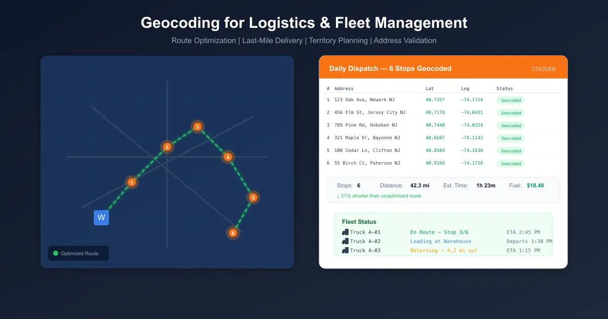
Last-mile delivery accounts for 53% of total shipping costs. Geocoding every delivery address lets you cluster stops by proximity, sequence them for minimum drive time, and identify addresses that will cause problems before the truck leaves the depot. A regional parcel carrier geocoding 8,000 daily stops reduced their per-package delivery cost by 22% — simply because drivers stopped backtracking to addresses they couldn't find the first time.
Fleet Route Planning
Route optimization engines need coordinates, not street addresses. Route optimization geocoding means converting your entire stop list to lat/long before feeding it to your routing algorithm. This applies whether you're planning next-day delivery routes or scheduling weekly service calls. One HVAC fleet with 120 technicians cut 35 minutes per day per driver after geocoding their entire customer database and re-optimizing territories.
Territory & Zone Management
Drawing delivery zones on a map is easy. Making sure every address actually falls into the right zone requires geocoding. When you have coordinates for every customer, you can build balanced territories based on actual stop density rather than zip code boundaries — which often don't reflect real driving patterns. Food delivery platforms use this to set accurate delivery boundaries and realistic ETAs.
Warehouse & DC Site Selection
Choosing where to place a new distribution center means analyzing where your deliveries actually go. Geocode your last 12 months of delivery addresses, plot them on a map, and you can calculate the optimal facility location that minimizes total drive distance. A mid-size e-commerce fulfillment company used this approach to place their second warehouse, reducing average delivery distance by 31%.
Proof of Delivery Verification
When a driver marks a delivery as complete, you can compare the GPS coordinates from their device against the geocoded delivery address. If the driver is more than 200 meters from the expected location, something's wrong — either the address was bad or the delivery didn't happen where it should have. This eliminates disputes and gives you auditable delivery records.
Customer Address Validation at Intake
The cheapest time to fix a bad address is before it enters your system. Geocoding addresses at the point of order — whether that's a web checkout, a call center, or an EDI feed — catches problems immediately. If an address doesn't geocode, it gets flagged for review instead of causing a failed delivery three days later. This single practice typically reduces address-related delivery failures by 60-70%.
How to Geocode Delivery Addresses: 3 Methods
There's no single "right way" to geocode delivery addresses — the best method depends on your volume, your systems, and how technical your team is. Here are the three main approaches, with step-by-step instructions for each.
Method 1: Batch File Upload for Dispatch Lists
Best for: Daily route planning, periodic address database cleanup, dispatch teams without developer support
If your dispatch team works with Excel or CSV files — exporting stop lists from your TMS, cleaning them up, and importing them back — batch geocoding is the fastest path to coordinates.
How it works:
- Export your delivery address list as a CSV or Excel file
- Upload it to CSV2GEO
- Map your columns (street, city, state, zip, country)
- Click process — CSV2GEO geocodes every row and returns lat/long coordinates
- Download the enriched file and import it back into your routing system
This works for files with hundreds of thousands of rows. If you need to geocode large files, CSV2GEO handles them without breaking a sweat.
The free tier gives you 100 rows per day — enough for a small fleet operator to geocode a daily dispatch list. For larger operations, paid plans handle millions of rows.
Method 2: API Integration into TMS/WMS Systems
Best for: Automated workflows, real-time address validation, development teams building logistics software
If you want geocoding built directly into your Transportation Management System (TMS) or Warehouse Management System (WMS), the geocoding API is what you need. CSV2GEO provides 19 API endpoints covering single-address geocoding, batch processing, reverse geocoding, and more.
API endpoint:
GET https://api.csv2geo.com/v1/geocode?q={address}&country={country}&api_key={key}Python integration example — real-time geocoding for TMS:
import requests

API_KEY = "geo_live_your_api_key_here"
BASE_URL = "https://api.csv2geo.com/v1/geocode"

def geocode_delivery_address(address: str, country: str = "US") -> dict:
    """Geocode a single delivery address for TMS integration."""
    response = requests.get(BASE_URL, params={
        "q": address,
        "country": country,
        "api_key": API_KEY
    })
    data = response.json()

    if data.get("status") == "ok":
        return {
            "latitude": data["results"][0]["latitude"],
            "longitude": data["results"][0]["longitude"],
            "confidence": data["results"][0]["confidence"],
            "formatted_address": data["results"][0]["formatted_address"]
        }
    return None

# Example: geocode an incoming order address
order_address = "1455 Market Street, San Francisco, CA 94103"
coords = geocode_delivery_address(order_address)

if coords and coords["confidence"] >= 0.8:
    print(f"Geocoded: {coords['latitude']}, {coords['longitude']}")
    # Insert coordinates into TMS stop record
else:
    print("Low confidence — flag for manual review")
Batch processing script for daily dispatch lists:
import requests
import csv
import time

API_KEY = "geo_live_your_api_key_here"
BASE_URL = "https://api.csv2geo.com/v1/geocode"

def geocode_dispatch_list(input_file: str, output_file: str):
    """Process a daily dispatch CSV and add coordinates."""
    with open(input_file, "r") as infile, open(output_file, "w", newline="") as outfile:
        reader = csv.DictReader(infile)
        fieldnames = reader.fieldnames + ["latitude", "longitude", "confidence"]
        writer = csv.DictWriter(outfile, fieldnames=fieldnames)
        writer.writeheader()

        for row in reader:
            address = f"{row['street']}, {row['city']}, {row['state']} {row['zip']}"
            try:
                response = requests.get(BASE_URL, params={
                    "q": address,
                    "country": row.get("country", "US"),
                    "api_key": API_KEY
                })
                data = response.json()

                if data.get("status") == "ok":
                    result = data["results"][0]
                    row["latitude"] = result["latitude"]
                    row["longitude"] = result["longitude"]
                    row["confidence"] = result["confidence"]
                else:
                    row["latitude"] = ""
                    row["longitude"] = ""
                    row["confidence"] = "FAILED"

            except Exception as e:
                row["latitude"] = ""
                row["longitude"] = ""
                row["confidence"] = f"ERROR: {e}"

            writer.writerow(row)

    print(f"Dispatch list geocoded. Output: {output_file}")

# Run daily before route optimization
geocode_dispatch_list("dispatch_2026-04-09.csv", "dispatch_geocoded.csv")
The free API tier gives you 3,000 requests per day — solid for testing and small operations. For more on API integration, see how to geocode in Python.
Method 3: Google Sheets for Small Fleet Operators
Best for: Small businesses with 10-50 daily deliveries, non-technical users, quick one-off projects
If you manage your delivery schedule in a spreadsheet, you don't need any coding at all. CSV2GEO works directly with Google Sheets — paste your addresses, run the geocoding add-on, and get coordinates right in your spreadsheet.
Check the full walkthrough: Google Sheets geocoding.
This is perfect for small fleet operators — think local courier services, catering companies, or home service businesses — who need coordinates for daily route planning without any technical setup.
Method Comparison: Batch vs API vs Sheets
| Feature | Batch File Upload | API Integration | Google Sheets |
|---|---|---|---|
| Best for | Dispatch teams, periodic cleanup | Automated TMS/WMS workflows | Small fleets, non-technical users |
| Volume | Up to hundreds of thousands of rows | Unlimited (rate-limited) | Hundreds of rows |
| Speed | Minutes for large files | Real-time (sub-second per request) | Seconds per batch |
| Technical skill | None — upload and click | Developer required | None — works in spreadsheet |
| Automation | Manual upload | Fully automated | Semi-manual |
| Free tier | 100 rows/day | 1,000 requests/day | 100 rows/day |
| Use case fit | Daily dispatch planning | Real-time order validation | Local route planning |
TMS/WMS Integration Comparison
Integrating geocoding into your existing logistics systems is where the real operational leverage comes from. Here's how geocoding logistics integration works across common system types:
| System Type | Integration Method | Trigger Point | Typical Latency | Recommended Approach |
|---|---|---|---|---|
| TMS (Transportation Management) | REST API webhook | New shipment created | <200ms per address | Real-time API call on order intake |
| WMS (Warehouse Management) | Batch API or file upload | Daily pick list generation | Minutes for full list | Batch geocode before route optimization |
| OMS (Order Management) | REST API | Order placement | <200ms per address | Validate + geocode at checkout |
| Route Optimization Software | CSV upload or API | Before route calculation | Seconds to minutes | Pre-geocode all stops, feed coordinates |
| CRM / Customer Database | Batch file upload | Periodic (weekly/monthly) | Minutes for full database | Batch geocode entire customer list |
| ERP System | REST API or middleware | New customer/location record | <200ms per address | Geocode on record creation |
The key principle: geocode as early as possible in your data pipeline. The closer to the point of data entry, the fewer downstream problems you'll have.
Cost Comparison: Geocoding ROI for Logistics
Let's do the math. Here's what last mile delivery geocoding actually saves for a mid-size delivery operation running 200 deliveries per day:
| Metric | Before Geocoding | After Geocoding | Annual Savings |
|---|---|---|---|
| Failed deliveries | 6% rate (12/day) | 2% rate (4/day) | 8 fewer failures/day x $17.20 = $50,200/year |
| Fuel costs | $850/day fleet fuel | $680/day (20% reduction) | $170/day savings = $62,050/year |
| Driver time | 45 min/day wasted per driver (10 drivers) | 15 min/day wasted per driver | 5 hrs/day saved x $25/hr = $45,625/year |
| Customer complaints | 18 address-related complaints/week | 5 complaints/week | Support time + retention value = $15,000/year |
| Total annual savings | $172,875/year | ||
| CSV2GEO cost | From $0 (free tier) to ~$1,200/year | ||
| ROI | 14,000%+ |
These aren't hypothetical numbers. They're based on industry averages from logistics operations that implemented address geocoding and validation into their workflows. The failed delivery cost ($17.20) comes from the last-mile delivery industry average that includes fuel, driver time, re-delivery scheduling, and customer service handling.
The point is simple: geocoding pays for itself on day one. Even the free tier (100 rows/day file upload + 1,000 API requests/day) covers a significant chunk of a small fleet's needs.
For operations handling more volume, start with free geocoding to test the accuracy, then scale up as you integrate it into your production workflow.
Best Practices for Logistics Geocoding
After working with hundreds of logistics companies, here are the practices that separate the ones getting real results from the ones just checking a box.
1. Fix Address Quality at the Source
Geocoding can handle messy data, but garbage in still means lower confidence out. The biggest wins come from:
- Standardizing address formats before geocoding (street, city, state, zip in separate columns)
- Requiring zip/postal codes — they dramatically improve geocoding accuracy
- Validating at point of entry — geocode customer addresses when orders come in, not when trucks are about to leave
- Including country codes for international shipments — "US", "CA", "GB" etc.
2. Know When to Use Batch vs Real-Time
| Scenario | Use Batch | Use Real-Time API | |----------|-----------|-------------------| | Daily dispatch planning | Yes | No | | Customer order intake | No | Yes | | Monthly database cleanup | Yes | No | | Live driver re-routing | No | Yes | | Historical delivery analysis | Yes | No | | Address validation at checkout | No | Yes |
Batch geocoding (via file upload or batch API) is for planned operations. Real-time API is for moments where a customer or driver is waiting. Don't use real-time when batch will do — it's wasteful. Don't use batch when you need instant validation — it's too slow.
3. Cache Geocoded Results
If you're geocoding the same customer addresses repeatedly (e.g., subscription deliveries, regular service routes), cache the results. Geocode each unique address once, store the coordinates in your database, and only re-geocode when the address changes.
This approach:
- Reduces API calls by 60-80% for repeat-delivery businesses
- Speeds up daily dispatch planning (coordinates are already there)
- Saves money on geocoding costs
4. Set Confidence Thresholds
Not all geocoding results are equal. CSV2GEO returns a confidence score with each result. For logistics, set these thresholds:
- Confidence >= 0.9: Auto-accept. Coordinates are reliable for routing and delivery.
- Confidence 0.7 - 0.9: Use for routing but flag for driver review. The location is approximate.
- Confidence < 0.7: Flag for manual review before dispatch. The address likely has issues.
5. Geocode Your Entire Customer Database (Not Just Today's Deliveries)
Most logistics companies only geocode addresses when they need them for immediate routing. Geocode your entire customer database — even addresses you haven't delivered to in months. This gives you:
- Territory analysis and zone optimization based on complete data
- Instant routing for any customer without waiting for geocoding
- Historical delivery density maps for strategic planning
Use the batch file upload to geocode a CSV file of your entire customer list. Do this quarterly to catch any new or changed addresses.
6. Monitor Geocoding Failures
Track which addresses fail to geocode or return low confidence scores. These are your problem addresses — they're the ones causing failed deliveries. Build a weekly report of geocoding failures and have someone review and fix the underlying address data.
Frequently Asked Questions
How accurate is geocoding for delivery addresses?
CSV2GEO typically achieves rooftop-level accuracy for well-formatted addresses in supported countries. This means coordinates land within 10-50 meters of the actual delivery point. For addresses with only a zip code or city, accuracy drops to the centroid of that area. The confidence score in the API response tells you exactly how precise each result is — always check it before routing drivers to a location.
How many addresses can I geocode per day?
With free tiers, you get 100 rows per day via file upload and 3,000 API requests per day. Paid plans scale to millions of rows and tens of thousands of API requests per day. For a fleet running 200+ daily deliveries, a paid plan is the way to go. For small fleets under 100 stops/day, the free tier covers you completely.
Can I geocode international delivery addresses?
Yes. CSV2GEO supports geocoding in 200+ countries. You'll get the best accuracy when you include the country code (ISO 2-letter) with each address. This is essential for cross-border logistics, international e-commerce fulfillment, and global supply chain operations. European, North American, Asian, and Australian addresses all work.
How do I integrate geocoding into my TMS?
Use the CSV2GEO geocoding API. The simplest integration is a webhook that fires when a new shipment is created in your TMS — it sends the delivery address to the API, gets back coordinates, and stores them on the shipment record. Most TMS platforms (Oracle TMS, SAP TM, Blue Yonder, MercuryGate) support webhook or API integrations. The Python example earlier in this article shows the basic pattern. With 19 API endpoints available, you can handle single-address lookups, batch processing, and reverse geocoding.
What happens with incomplete or misspelled addresses?
CSV2GEO uses fuzzy matching and address parsing to handle common issues — missing apartment numbers, misspelled street names, swapped city/state fields. The geocoder will return its best match along with a confidence score. If the confidence is below your threshold, you know the address needs manual review. For last mile delivery geocoding, we recommend flagging anything below 0.7 confidence for human review before dispatch.
Is geocoding fast enough for real-time dispatch?
Yes. The API typically responds in under 200 milliseconds per address. That's fast enough for real-time address validation at checkout, live dispatch adjustments, and driver re-routing. For batch operations (like geocoding tomorrow's 500-stop dispatch list), the batch upload processes hundreds of rows per minute.
How much does logistics geocoding cost?
CSV2GEO offers a free tier that covers small operations: 100 rows/day via file upload and 1,000 API requests/day. Paid plans start low and scale based on volume. Given that a single failed delivery costs $17.20 on average, even premium geocoding plans pay for themselves within the first week. See the ROI table above for detailed calculations.
Can I geocode addresses in bulk from Excel/CSV?
Absolutely. This is one of the most common use cases for logistics companies. Export your address list from any system as a CSV or Excel file, upload it to CSV2GEO, and download the geocoded results with latitude and longitude columns added. You can geocode a CSV file with hundreds of thousands of rows in minutes. No coding required.
Related Articles
- Free Batch Geocoding: How to Geocode a CSV File — Step-by-step guide to geocoding your first delivery address file
- How to Geocode Addresses in Python — Build geocoding into your logistics automation scripts
- How to Geocode Addresses in Google Sheets — Perfect for small fleet operators managing routes in spreadsheets
- How to Geocode a Large File — Handle massive address databases for enterprise logistics
- CSV2GEO Geocoding API Documentation — Full API reference for TMS/WMS integration with 19 endpoints
*I.A. / CSV2GEO Creator*
Use our batch geocoding tool to convert thousands of addresses to coordinates in minutes. Start with 100 free addresses.
Try Batch Geocoding Free →