200 Countries, 200 Ways to Write an Address
Street types, name order, postal code collisions — 135,000+ address format combinations worldwide. See how CSV2GEO handles them all. Free tool.
This is Part 3 of our Address to Coordinates series. Read Part 1: Will Geocoding Decide the War Between Humans and AI? and [Link: Part 2: The House Number Problem | /blog/house-number-problem-geocoding] for the full context.
Here is a number that should terrify anyone building a geocoding system: 135,000. That’s the estimated number of address component combinations used worldwide. Not 135,000 addresses — 135,000 ways to structure an address.
In Part 2, we explored how a single component — the house number — has over 20 formats. Now multiply that complexity across every other component: street types, directional prefixes, postal codes, city hierarchies, floor and unit identifiers, building names, districts, provinces, and the order in which they all appear. The result is a combinatorial explosion that makes geocoding one of the hardest data problems on the planet.
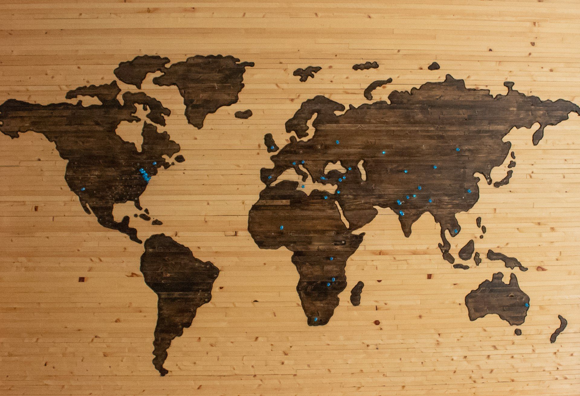
This is the story of how 200+ countries created 200+ ways to describe the same thing: where a building is. And why every one of those ways matters.
Street Types and Address Components Around the World
Street types alone would fill a book. In the United States, there are over 50 official street type suffixes recognized by the USPS: Street, Avenue, Boulevard, Lane, Drive, Way, Place, Court, Circle, Terrace, Trail, Parkway, Highway, Expressway, Freeway — and that’s not even half the list. Each has an approved abbreviation (St, Ave, Blvd, Ln, Dr, Way, Pl, Ct) and several unofficial variations that people use anyway (Str, Av, Boul).
Germany has its own set: Straße (street), Weg (way), Gasse (lane), Platz (square), Allee (avenue), Damm (embankment), Ring (ring road), Chaussee (highway). Each can be appended to a name as a compound word: Friedrichstraße is Friedrich + Straße. But it can also be written as two words: Friedrich Straße. Or abbreviated: Friedrichstr. A geocoder must recognize all three as the same street.
Australia adds tropical flair: Terrace (Tce), Esplanade (Esp), Parade (Pde), Crescent (Cres), Close (Cl). French-speaking countries contribute: Rue, Avenue, Boulevard, Passage, Impasse, Allée, Chemin, Quai. Spanish-speaking countries: Calle, Avenida, Paseo, Carrera, Carretera, Camino, Callejón. Portuguese: Rua, Avenida, Travessa, Largo, Praça, Alameda.
A geocoder processing international addresses must recognize hundreds of street type suffixes and prefixes, in dozens of languages, including their abbreviations and misspellings. And it must know that "Rue" in a French address means "Street" and should be treated as a type prefix, while "Avenue" in both English and French means the same thing but appears in different positions relative to the street name.
Address Component Order: Name Before Number vs Number First
The order of address components varies dramatically across countries — and not just for house numbers. The entire structure of an address changes depending on where you are.
| Country | Format | Example | Component Order |
|---|---|---|---|
| United States | Number → Street → City → State → ZIP | 350 5th Ave, New York, NY 10118 | Small → Large |
| Germany | Street → Number, PLZ → City | Friedrichstraße 43, 10117 Berlin | Small → Large (postal code before city) |
| Japan | Postal → Prefecture → City → District → Block → Building | 〒105-0001 東京都港区苝1-2-3 | Large → Small |
| Brazil | Street, Number → Neighborhood → City → State | Av. Paulista, 1578 - Bela Vista, São Paulo - SP | Small → Large (dashes as separators) |
| Spain | Street Number, Floor Door, ZIP City | Calle Gran Vía 28, 3º Izq, 28013 Madrid | Small → Large (floor + door in address) |
| South Korea | Province → City → District → Road → Number | 서울특별시 중구 세종대로 110 | Large → Small (since 2014 reform) |
| China | Province → City → District → Street → Number | 北京市东城区王府井大街27号 | Large → Small |
| United Kingdom | Number → Street, City, Postcode | 10 Downing Street, London, SW1A 2AA | Small → Large |
Notice the fundamental split: Western countries generally go small-to-large (building → street → city → country), while East Asian countries go large-to-small (country → province → city → building). This isn’t arbitrary — it reflects different cultural approaches to hierarchy and specificity. Japanese addressing starts with the broadest context and narrows down, just like Japanese names put family name before given name.
For a geocoder, this means the parsing logic must be inverted depending on the country. A system that reads left-to-right looking for a house number first will completely fail on Japanese, Chinese, and Korean addresses where the house number (or building number) appears last.

Postal Code Formats: The Global Chaos
If address formats are chaotic, postal codes are anarchic. Every country that uses them has invented its own system, with its own length, format, and logic. There is no international standard. There never will be.
| Country | Name | Format | Example | Total Codes |
|---|---|---|---|---|
| United States | ZIP Code | 5 digits (or 5+4) | 10118 / 10118-0001 | ~42,000 |
| United Kingdom | Postcode | Alphanumeric (outward + inward) | SW1A 1AA | ~1,800,000 |
| Canada | Postal Code | Letter-Number-Letter Number-Letter-Number | K1A 0B1 | ~850,000 |
| Germany | Postleitzahl (PLZ) | 5 digits | 10117 | ~28,000 |
| Japan | Postal Code | 7 digits (3+4) | 105-0001 | ~120,000 |
| Brazil | CEP | 8 digits (5+3) | 01310-100 | ~900,000 |
| Australia | Postcode | 4 digits | 0200 | ~2,600 |
| Netherlands | Postcode | 4 digits + 2 letters | 1012 AB | ~450,000 |
| India | PIN Code | 6 digits | 110001 | ~155,000 |
| Ireland | Eircode | 7 alphanumeric | D02 AF30 | ~2,200,000 |
The UK system is particularly fascinating. British postcodes are so precise that "SW1A 1AA" identifies not just a neighborhood but a specific delivery point — in this case, Buckingham Palace. The UK has 1.8 million postcodes for 67 million people, while the US uses only 42,000 ZIP codes for 330 million people. British postcodes are practically street-level addresses; American ZIP codes cover entire towns.
Australia’s 4-digit postcodes create a different problem: leading zeros. Postcode 0200 serves parts of the Australian Capital Territory. But in most spreadsheet software, 0200 becomes 200 — which is a different postcode (in New South Wales). This single leading-zero issue has caused more geocoding failures than almost any other formatting problem. If you’ve ever uploaded a CSV and wondered why your Australian addresses failed, check the postal code column.
Ireland didn’t have postcodes at all until 2014, when it launched Eircode — a system so granular that each of the country’s 2.2 million addresses gets a unique 7-character code. Before Eircode, Irish addresses were so informal that the postal service relied on local knowledge and the postman’s memory.
Countries with No Postal Codes at All
Postal codes seem universal, but they’re not. More than 30 countries and territories have no postal code system at all. Some notable examples:
- Hong Kong — Despite being one of the most densely populated places on Earth, Hong Kong has no postal codes. Mail is sorted by district name and street address.
- Panama — No postal code system. Addresses use neighborhood names and landmarks.
- Tonga, Fiji, Kiribati — Many Pacific Island nations have no postal codes and limited formal addressing.
- Qatar and UAE — Historically no postal codes, though PO Box systems are common. Qatar introduced zone numbers in 2014.
- Many African nations — Formal postal code systems exist on paper but are inconsistently used or cover only urban areas.
For geocoding, this means you cannot rely on postal codes as a universal filtering mechanism. A geocoder must be able to match addresses without postal codes — using street name, city, and country alone. This requires more sophisticated matching logic and a broader search space, which is why postal-code-dependent geocoders fail in these countries while more robust systems succeed.
When ZIP Codes Collide: The 5-Digit Trap
Here is a question that has silently corrupted millions of geocoding results: what happens when you send the postal code "10001" to a geocoder without specifying a country?
Most people assume 10001 means Manhattan, New York. But 10001 is also the postal code for central Tallinn, Estonia. And 10115? That is Berlin Mitte in Germany — and also a valid New York ZIP code. The same five digits, pointing to locations 6,000 kilometers apart.
This is not an edge case. At least 12 countries use purely numeric 5-digit postal codes with overlapping ranges:
| Code | United States | Also Valid In | Distance Apart |
|---|---|---|---|
| 10001 | Manhattan, New York | Tallinn, Estonia | 6,800 km |
| 10117 | New York, NY | Berlin, Germany | 6,400 km |
| 75001 | Addison, TX (Dallas) | Paris, France (1st arr.) | 8,000 km |
| 28001 | Albemarle, NC | Madrid, Spain | 6,300 km |
| 01069 | Palmer, MA | Dresden, Germany | 6,100 km |
| 50001 | Ackworth, IA | Zaragoza, Spain | 7,200 km |
The full list of countries sharing the 5-digit numeric format includes the United States, Germany, France, Italy, Spain, Estonia, Lithuania, Mexico, South Korea, Turkey, Malaysia, Indonesia, and Saudi Arabia. Their postal code ranges overlap almost completely. Without a country field, a geocoder is literally guessing which continent you mean.
This is why country detection is the very first step in any serious geocoding pipeline — before parsing the street, before matching the postal code, before anything else. If your data has a country column, always include it. If it does not, you are at the mercy of whatever default the geocoding engine assumes. Most default to the United States. If your data is from Estonia, you will get results in New York. If it is from France, you will get results in Texas.
CSV2GEO handles this by requiring a country field in batch uploads and API requests. The AI column detector flags country columns automatically — and if none is found, it prompts you to specify one. This single design decision prevents more geocoding errors than any amount of fuzzy matching ever could.
The Math Behind 135,000 Address Format Combinations
Where does the 135,000 number come from? Let’s break it down. An address is composed of multiple components, each with its own variation space.
| Dimension | Variations | Examples |
|---|---|---|
| Countries | ~200 | Each with unique addressing conventions |
| Address components | ~15 per country | House number, street type, street name, unit, floor, building name, neighborhood, district, city, province, postal code, country, PO Box, landmark, attention line |
| Component order | ~5 per country | Small-to-large, large-to-small, mixed, with/without commas, with/without line breaks |
| Encoding schemes | ~3 per component | Latin script, local script, transliterated (e.g., Japanese in romaji) |
| Language variants | ~2 average | Belgian addresses in French and Dutch; Swiss in German, French, Italian |
The calculation: 200 countries × 15 components × 5 ordering variations × 3 encodings × variable language factors yields a combinatorial space well into six figures. And this is conservative — it doesn’t account for historical format changes (Germany reunification changed East German addresses), regional exceptions (Queens, New York’s hyphenated format), or informal addressing (Costa Rica’s landmarks).
The practical implication? No single regex, no single parsing template, and no single lookup table can handle all addresses. A geocoder must be a multi-strategy system that detects the country, infers the format, parses the components, normalizes them, and matches against a database — all in milliseconds. This is why building a global geocoder is a multi-year engineering challenge, not a weekend project.
How CSV2GEO Handles 200 Countries Without Breaking
Step 1: Understand the Scale of Global Address Complexity
Everything described in this article — the street type variations, the inverted address orders, the postal code collisions, the countries with no codes at all — is a problem CSV2GEO solves every day, millions of times. The system was built from scratch to handle the full spectrum of global address formats, not as an afterthought bolted onto a single-country geocoder.
The core architecture uses eight search strategies, tried in sequence from most precise to broadest. Each strategy is tuned per country, because what works for German addresses (postcode + compound street name) fails completely for Japanese addresses (block-lot hierarchy with no street names).
Step 2: Apply Multi-Strategy Geocoding
Postcode Strategies (1–3)
Narrow by postal code first. Strategy 1 matches postcode + street + house number for rooftop precision. Strategy 2 drops the house number. Strategy 3 uses postcode alone — still useful when streets are misspelled or abbreviated differently.
Handles leading zeros (Australia), alphanumeric codes (UK, Canada), and 5-digit collisions (with country context).
City Strategies (4–5b)
When postcodes are missing or unreliable (Hong Kong, Panama, much of Africa), search by city + street + house number. Strategy 5b handles a common parsing bug: when address parsers merge the city name into the street field, CSV2GEO splits the last word(s) off and tries them as the city.
This alone recovers thousands of otherwise-failed matches per day.
Street Strategies (6–7)
For ambiguous city data, use street-level matching with case-sensitive regex on title-cased and uppercased variants — enabling MongoDB B-tree prefix scans for speed.
Handles German compound words (Friedrichstraße), French bis/ter suffixes, Spanish floor+door notation, and European prepositions (von, van, de, der, den, la).
Geocache + Fallback (8)
Before all strategies, CSV2GEO checks its geocache — a high-confidence result store that returns instant matches for previously resolved addresses. When all structured strategies are exhausted, the fallback combines partial matches with geographic context.
Every result gets an honest confidence score from 0 to 1.0, so you always know how precise the match is.
The difference between a toy geocoder and a production system is what happens when the obvious approach fails. Most geocoders try one strategy: parse the address, look up the postcode, return a result. CSV2GEO tries eight, in order, with per-country tuning and per-strategy timeouts. The first strategy that returns a high-confidence match wins. If none do, you get the best partial match with a confidence score that tells you exactly how much to trust it.
Step 3: See How Eight Strategies Resolve One Address
Consider the address "Friedrichstr. 43, Berlin" — no postal code, abbreviated street type, no country specified. Here is what happens inside CSV2GEO:
| Strategy | What It Tries | Result |
|---|---|---|
| 1–3 (Postcode) | No postcode provided | Skipped |
| 4 (City + Street) | city=Berlin, street=Friedrichstr, number=43 | Expands "Friedrichstr" → "Friedrichstraße" → Match found |
| 5–7 | Not needed | Skipped (Strategy 4 already matched) |
Result: 52.5163, 13.3889 — confidence 0.95. The abbreviated street type was expanded, the missing postcode was not required, and the country was inferred from the city name. Total time: under 200 milliseconds.
Try it yourself: upload a CSV or Excel file with international addresses at csv2geo.com/batchgeocoding — 100 rows per day, free. For programmatic access, the CSV2GEO API offers 18 endpoints including forward geocoding, reverse geocoding, batch processing, places search, and administrative divisions — with 1,000 free requests per day. Get your API key at csv2geo.com/api-keys.
Related Guides
For more on converting addresses to coordinates, see our guides: How to Geocode a CSV File covers batch processing step by step, [Link: How to Convert Address to Lat Long | /blog/how-to-convert-address-to-lat-long] explains single and bulk conversion, Geocoding in Excel walks through spreadsheet workflows, and [Link: Lat Long Reverse Lookup | /blog/lat-long-reverse-lookup-coordinates-to-address] shows how to go from coordinates back to addresses. For tool comparisons, see Best Batch Geocoding Tools.
Series Navigation
200 countries, 200 formats — and this is just one dimension. The full series explores every layer of the address-to-coordinates pipeline, from the big thesis to working code.
Part 1: The Big Thesis
Address to Coordinates: Will Geocoding Decide the War?
The 2,000-year history and why it matters for AI.
Part 2: The House Number Problem
Why "123" Is Not What You Think
20+ house number formats and why they break geocoding.
Part 3: You Are Here
200 Countries, 200 Ways to Write an Address
Street types, name order, postal codes, and 135,000 combinations.
Part 4: Coming Next
How to Convert Any Address on Earth to Coordinates
The practical guide with free tools, API, and Python SDK.
Frequently Asked Questions
How many address formats exist worldwide?
Researchers estimate over 135,000 possible address component combinations worldwide. This number comes from approximately 200 countries, each with ~15 address components, ~5 ordering variations, ~3 encoding schemes, and variable language factors. No two countries format addresses exactly the same way.
Why do some countries put the number before the street and others after?
Address component order reflects cultural conventions, not logic. English-speaking countries typically place the number first (350 5th Avenue), while most of continental Europe places the street first (Friedrichstraße 43). East Asian countries like Japan, China, and Korea go from large to small (province → city → district → building). These conventions evolved from postal history and have been standardized differently in each country.
Which countries don’t use postal codes?
More than 30 countries and territories have no postal code system, including Hong Kong, Panama, and many Pacific Island and African nations. Others like Ireland only adopted postal codes in 2014 (Eircode). Geocoders must handle addresses with and without postal codes, using alternative matching strategies when codes are unavailable.
Why do Australian postcodes break in spreadsheets?
Australian postcodes can start with zero (e.g., 0200 for parts of the Australian Capital Territory). Spreadsheet software like Excel treats columns as numbers by default, stripping the leading zero. Postcode 0200 becomes 200 — a different code in a different state. Always format postal code columns as text before importing data. CSV2GEO handles this automatically during processing.
How does CSV2GEO handle addresses from 200+ countries?
CSV2GEO maintains 461M+ addresses across 200+ countries with country-specific parsing and matching logic. The system uses eight search strategies tried in order from most precise to least: postcode-based, city-based, street-based, and fallback matching. Each result includes a confidence score from 0 to 1.0. Upload a test file at csv2geo.com/batchgeocoding to see results for your addresses.
What are the most common street type suffixes?
The United States alone has 50+ official street type suffixes (Street, Avenue, Boulevard, Lane, Drive, Way, Place, Court, etc.). Germany uses Straße, Weg, Gasse, Platz, and others as compound word suffixes. French-speaking countries use Rue, Avenue, Boulevard, Passage. Spanish uses Calle, Avenida, Paseo. A global geocoder must recognize hundreds of suffixes across dozens of languages, including their abbreviations and common misspellings.
Can the same postal code exist in multiple countries?
Yes — and this is one of the most common causes of geocoding errors. At least 12 countries use 5-digit numeric postal codes with overlapping ranges, including the United States, Germany, France, Italy, Spain, and Estonia. The code 10001 is both Manhattan, New York and central Tallinn, Estonia. The code 75001 is both Addison, Texas and Paris, France. Without a country field, a geocoder cannot tell the difference. Always include country information in your data to avoid this problem.
I.A. — CSV2GEO Creator. Now that you understand the complexity, Part 4 will show you how to solve it — with working code.
Use our batch geocoding tool to convert thousands of addresses to coordinates in minutes. Start with 100 free addresses.
Try Batch Geocoding Free →