Auto-Create Interactive Maps from Geocoded Data
How Geocoding Automatically Creates Interactive Maps
Nowadays location is used widely around the globe for a large variety of purposes.
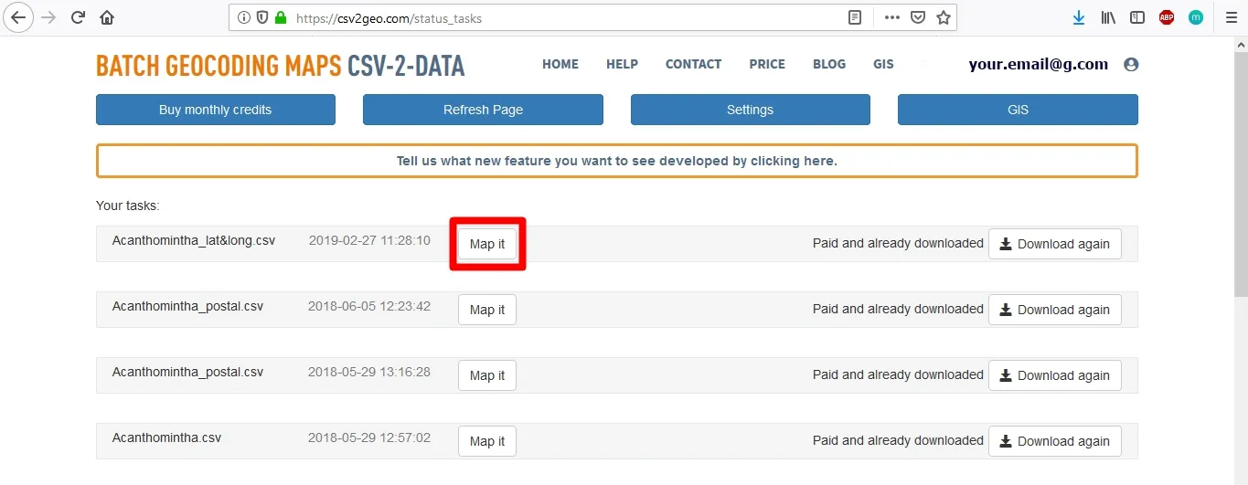
Whether you have to find your hotel, to reach your destination during your holiday or you must find out the address of the apartment that you are about to rent, location is the characteristic that will provide you the correct route. But what can be a location without a spatial representation like a map? A location defined only by some numeric values like geographic coordinates or like text and numeric values like an address will be nothing more than some characters without the spatial support provided by the map.Consequently, knowing the importance of the maps in modern society, here at CSV2GEO we have implemented the tool of Interactive Maps. CSV2GEO is a geocoder aimed to help users to run both geocoding and reverse geocoding processes. If other geocoding services provide only the geocoded values in different formats, here at CSV2GEO users have the possibility to get the results as CSV files, but also to map the locations obtained after geocoding or reverse geocoding. However, whether the user needs to convert zip postal codes into geographical coordinates or vice-versa, as soon as the process is complete, the user is able to create a map with user’s data by using “Interactive Maps” tool. In order to create the map based on the geocoded data the user should only click on the “Map it” button that will appear simultaneously with the “Download” button.
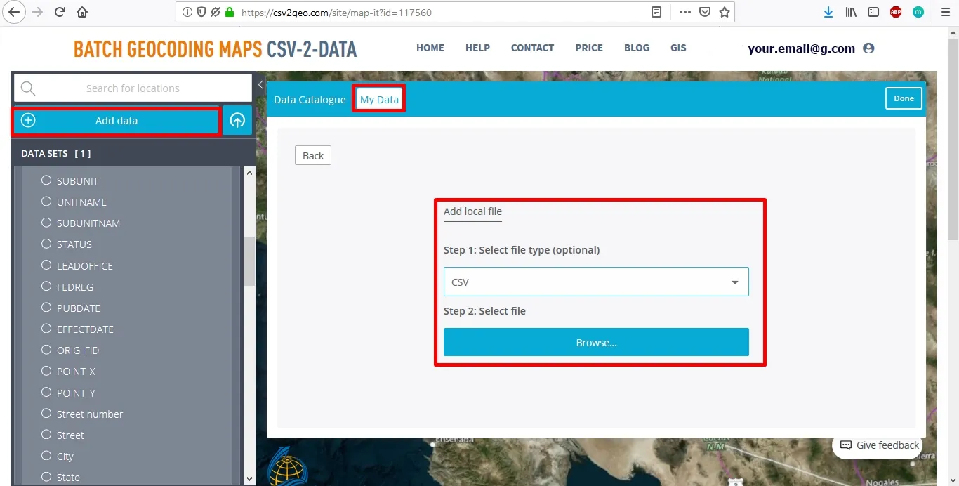
Because the core of mapping is a precise location, here at CSV2GEO we are focused first to provide an accurate location and only the next step is the creation of different maps. Moreover, when the user chooses to use the “Interactive Maps” tool implemented at CSV2GEO, the user has the functionality to upload geospatial data from external sources. Consequently, besides the fact that the user will obtain accurate values for the desired location and will have the chance to use different base maps already implemented in the “Interactive Maps” tool, there is also the possibility to upload data from other sources. In order to be able to integrate geospatial data from external sources, the user should upload files in different formats, such as GPX, GeoJSON, CSV and KML. On the other hand, users have also the functionality to upload data from servers such as Open Street Maps and ESRI.
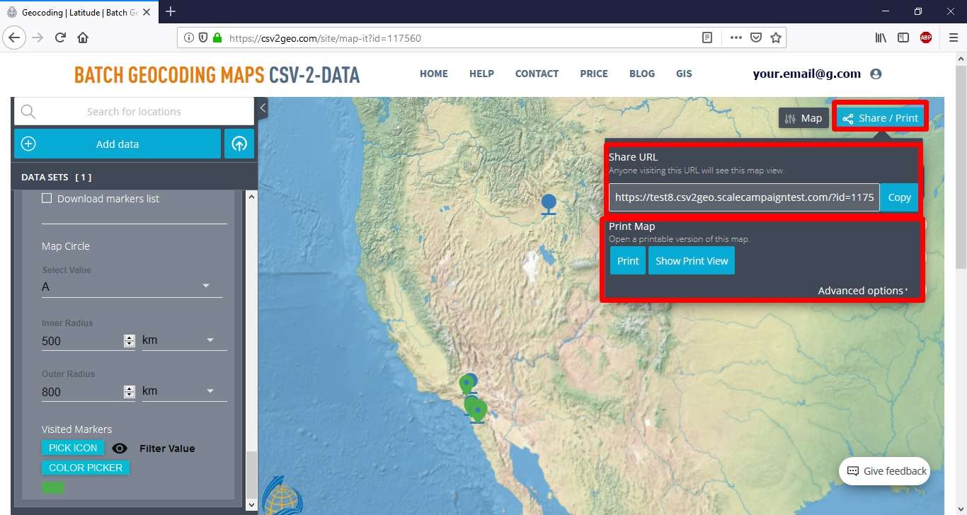
Geocoded data are very useful and necessary in a wide range of projects and spatial analysis. Since here at CSV2GEO users are able to run the geocoding process and then immediately to plot on the map the geocoded data, but also to integrate other data from external sources, this is very effective and time reducing. Moreover, the “Interactive Maps” tool allows the user to utilize the obtained maps both in digital format, but also as printed maps. As soon as the user is satisfied with the obtained map, a link with the map can be shared, but also the obtained map can be printed.
When you choose to use CSV2GEO, you will discover a complete geocoding and mapping tool. Actually, at CSV2GEO geocoded data auto-create interactive maps by using only one click. The aim of the “Interactive Maps” tool is to improve the interoperability between users’ data sets used for geocoding and reverse geocoding operations, and the spatial distribution of these data sets. Moreover, since we are aware that not everyone is an expert in Cartography and geospatial tools, here at CSV2GEO we have developed this “Interactive Maps” tool in order to be user-friendly and accessible for both general users and experts in the field of digital mapping. Furthermore, this tool is customizable and easy to edit since every user may require different maps for their projects.