Flexible Input File Formats
Multi-Column Address Input Support
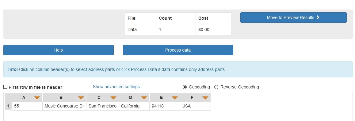
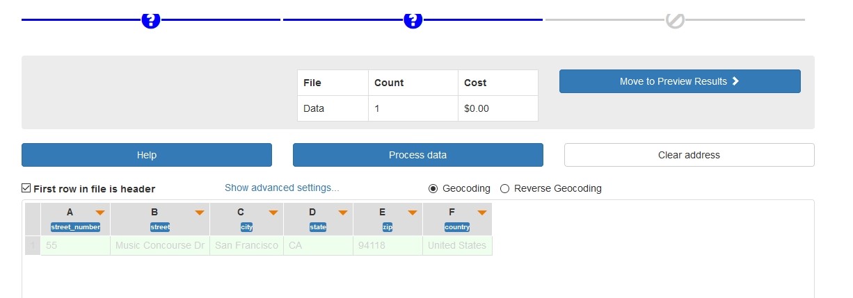
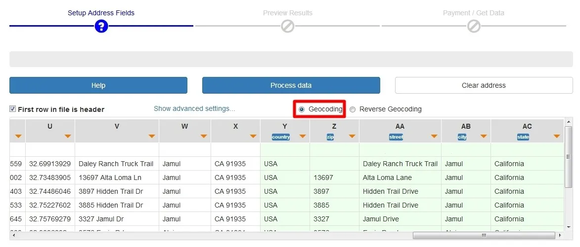
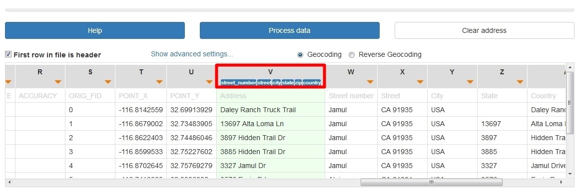
Standard address elements include “street number, street name, city name, state name, zip code, country”. Consequently, when a user utilizes address in GIS environments and in geocoding tools, the user may think that it is important to pay attention to the number of columns used for each address component at once. The good news is that here at CSV2GEO the number of columns during geocoding processes is not important and this geocoder is flexible regarding the input file format. Additionally, due to this flexibility in the input file format, any user can work with CSV2GEO tool without worries regarding the number of columns that should have the CSV file imported from GIS software or the number of columns that the output file will have after the geocoding or reverse geocoding processes.
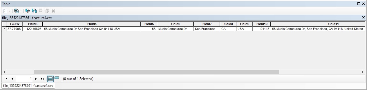
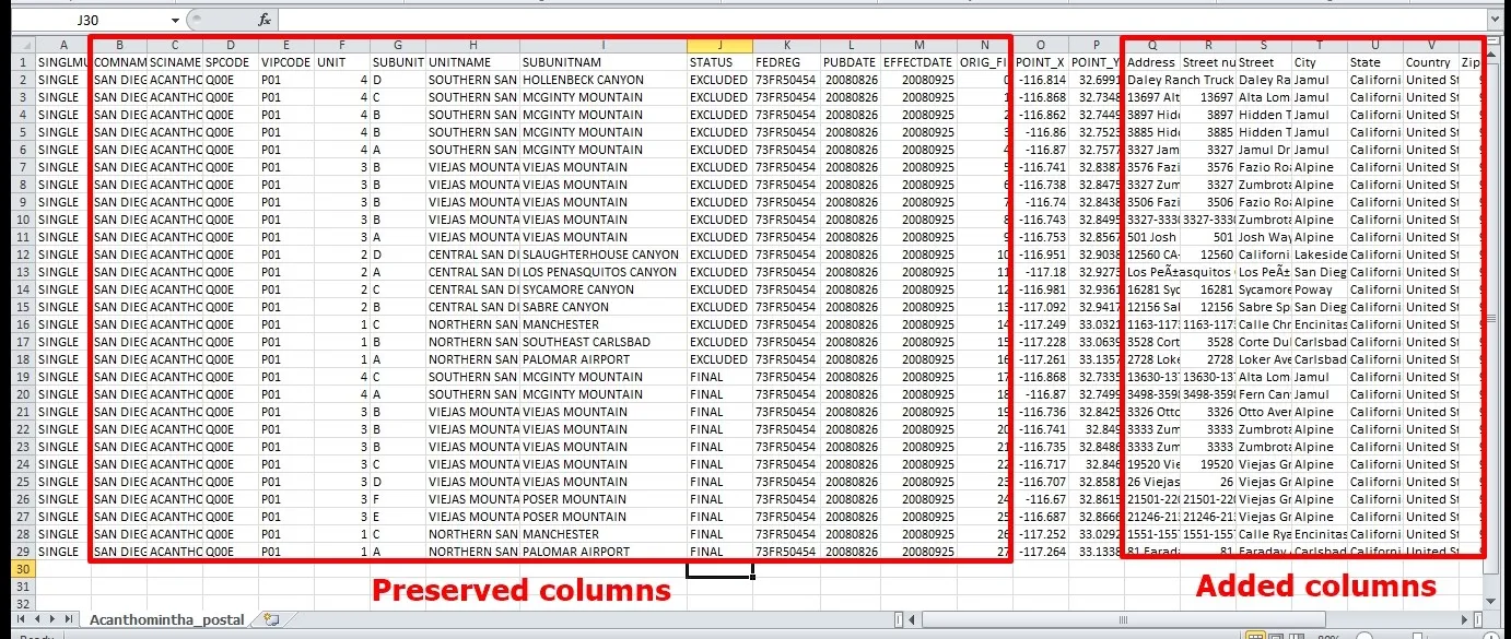
Moreover, CSV2GEO tool does not alter the input file. By using this geocoding tool, the user will have more columns added to those columns that are already in the input file. Instead of deleting or altering columns in the input file, after geocoding and reverse geocoding processes CSV2GEO tool add other columns to the right of the last column that was at the beginning of those two processes, preserving all the data available in the pre-existing columns in the input file. Consequently, after geocoding and reverse geocoding processes, the user can continue with mapping steps using the output file. The output file will contain now both input columns and new geocoded/reverse geocoded columns.
This feature regarding flexible input file format describing the CSV2GEO tool refers also to the header of the table. If some input files come with headers mentioning the “role” for each column in the table, there are also input files that are without headers. However, it is important to emphasize that CSV2GEO tool is not restricted to a certain input file header and the user can run geocoding or reverse geocoding processes even for input data without a header. Moreover, the output file can be also obtained without a header, but even so it is very clear which columns are attributed to geographic coordinates like latitude and longitude, and which columns are attributed to the entire address or to each element forming an address (street number, street name, city name, state name, zip code, country).
The images below show very well the flexibility regarding the input file format when using CSV2GEO tool in both aspects: number of columns and input files with header or without a header. Moreover, the output files are exemplified for both situations, with and without headers. Additionally, for an input file with many records preserved columns and the added columns are highlighted.
Due to this flexible input file format feature available at CSV2GEO, the user may be confident that the geocoding and reverse geocoding processes will run without any problem independently of the number of columns of the input files and if the input files come with headers or without headers. This flexibility of CSV2GEO tool means effectiveness in geocoding processes, but also means less time lost preparing the input files in order to have a certain format.