Feature 9 - Automatically Selection of Address Tokens
Auto-Detection of Address Components
Address components are very important in geocoding in order to get the correct geographic coordinates for a certain location. However, when we discuss about address components or address tokens we refer to elements such as street number, street name, city name, state name and country. Additionally, zip code may be also present in the address as an element. Consequently, all these components define an address.
During geocoding process address tokens selection may be very important to obtain the correct results after the process runs. The good news is that at CSV2GEO the user does not need to select any time the address tokens since there is a feature that does an automatically selection of address tokens. Consequently, this feature helps the user to have the correct address tokens if the header columns are common for more addresses or if the user runs the geocoding process for the second time during the same session.
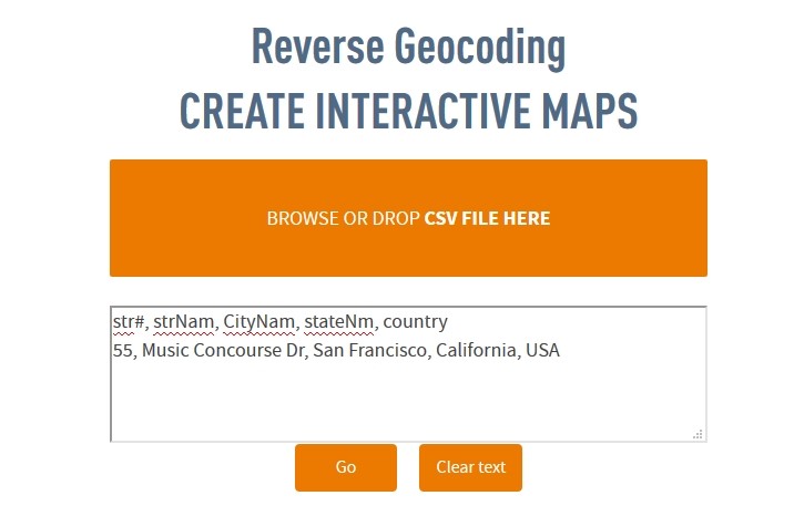
In order to explain better the feature of Automatically Selection of Address Tokens that is available at CSV2GEO, we will give an example of how this geocoder has the ability to remember the address tokens stored as headers previously and use these headers in further geocoding processes. Accordingly, we will take as the first example the address of the California Academy of Sciences in San Francisco, California. And for this location we will have the address “55, Music Concourse Dr, San Francisco, California, USA” and the header for this address will be “str#, strNam, CityNam, stateNm, country”.
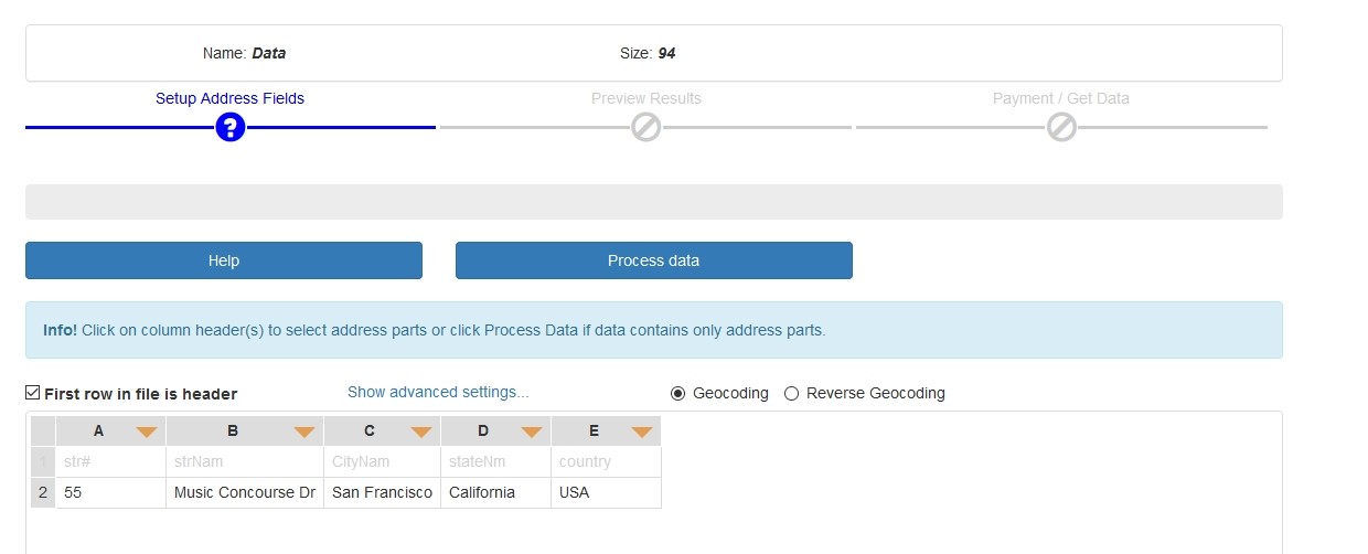
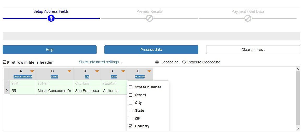
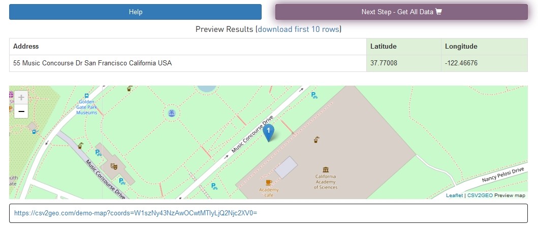
Then we will have the next step in the geocoding process at CSV2GEO and we will have to select address tokens in order to have the correct header for our location. After that user should click the “Process data” button and the geographic coordinates for the California Academy of Sciences in San Francisco, California is obtained and the results can be downloaded as a CSV file. This is the first step in our example regarding the Automatically Selection of Address Tokens feature that is available when using CSV2GEO tool.
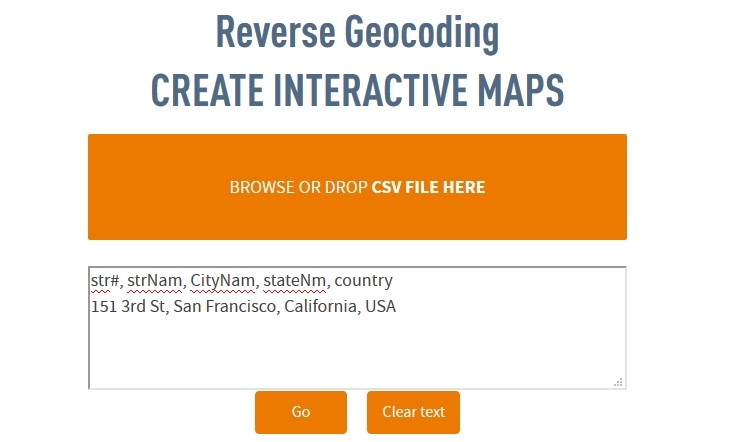
The second step is to take another location having a common header with that one used previously, namely “str#, strNam, CityNam, stateNm, country”, but this time the address will be for the San Francisco Museum of Modern Art. Accordingly, the address for this location will be “151, 3rd St, San Francisco, California, USA”.
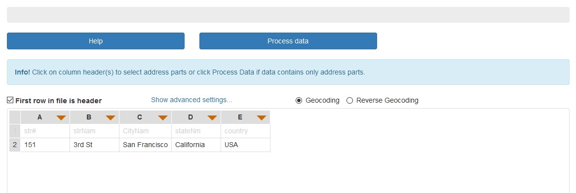
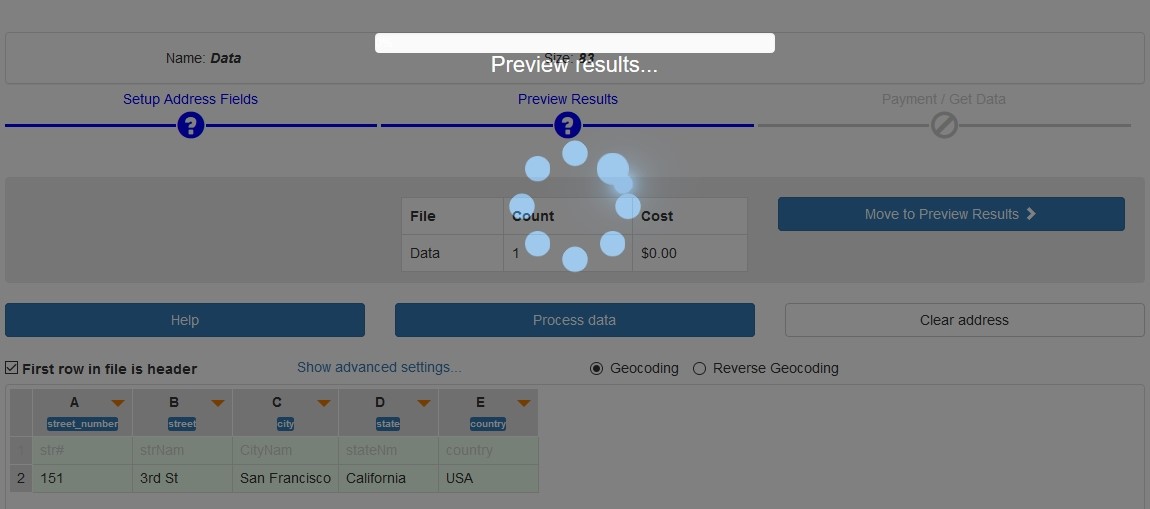
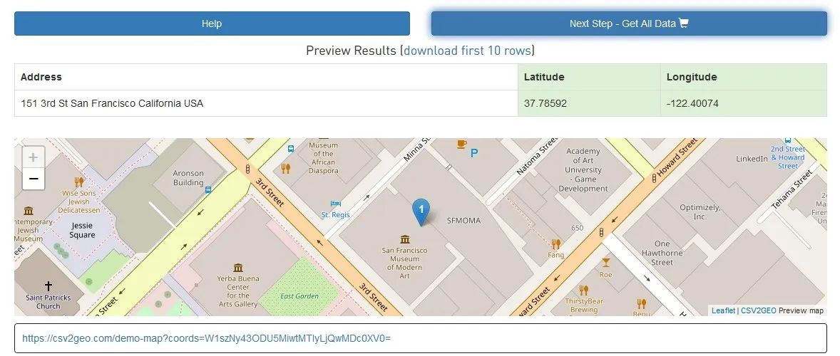
After the user will click on the “Go” button, the user will notice that the header had previously for the address tokens will be already selected and the user will just have to click on the “Process data” button this time, without being necessary to select the address tokens for each column. Moreover, after clicking on the “Process data” button the user will notice that during the geocoder runs the geocoding process, the address tokens are automatically selected by the CSV2GEO tool and the result is the correct geographic coordinates for the San Francisco Museum of Modern Art as the user can notice in the map showed at the end of the geocoding process.
This feature of Automatically Selection of Address Tokens that is available at CSV2GEO is due to a machine learning built in order to have the capability to adapt and remember previously stored address headers. Accordingly, this capability creates a big advantage for the user since the headers are already stored after the first geocoding process and the user can save time required for selection of the address tokens manually. Moreover, the user is confident that address tokens are selected automatically correct by the CSV2GEO tool and the final results are correct. Furthermore, instead of selecting the appropriate address tokens each time when the user intends to run the geocoding process, the machine learning implemented at CSV2GEO tool will do this automatically and the user must only click the “Process data” button in order to obtain the desired geographic coordinates for desired locations.