Help Endangered Species Problem Using Address to Lat Long
Introduction
The problem of species extinction is greatly common nowadays. Unfortunately, a tremendous number of species have been extinct in the last decades at the global scale and numerous other species are under the pressure of extinction now. North America has also an important number of species those are endangered. According to the United States Environmental Protection Agency (EPA), currently more than 1,300 endangered species are counted in North America. This fantastic number of endangered species represents a real problem for the wildlife management in North America.
Protecting endangered species
Causes of species extinction or endangering species are highly diverse. Accordingly, both natural and human changes to the Earth are causes of species extinction and endangering. Moreover, natural changes into the environment can be represented by volcano eruptions, glaciers melting or increasing of Earth temperature. On the other hand, human changes refer to habitat destruction, different types of pollution, new species those are introduced into areas where they should not be present or taking different species from their natural habitat.
Nevertheless, by protecting endangered species we as human beings protect the natural environment which represents our “home”. The environment is a chain and each species that lives on Earth has its role in this chain. Consequently, if one species is endangered, all those plants and animals those relate to the endangered species are becoming endangered in their turn.
Among the endangered species in North America we may mention the Mexican wolf, Florida bonneted bat, Ocelot, Vancouver Island marmot, woodland caribou, Central American river turtle, San Francisco garter snake, Barton Springs salamander and many others.
There are different plans and programs those are focused to assist in the protection of those endangered species in North America.
Using Geographic Information System (GIS) in wildlife management
Geographic Information System (GIS) can be a significant tool in wildlife management and endangered species problem. Since GIS can create different digital models of the reality, it is useful in wildlife management. One example can be the models representing the corridors of diverse wildlife species. Such wildlife corridors are generated by using GIS methods. In wildlife preservation, GIS may be extremely helpful for wildlife managers to map the endangered species and the habitats those are necessary for those endangered species. Moreover, GIS can be a great tool to analyze the effectiveness of natural reserves those are already developed or those natural areas those are proposed in order to protect different endangered species.
By using GIS, numerous endemic endangered species may be monitored in different areas and consequently may be assessed for conservation. Since endangered species are threatened by human activities, it is highly important to analyze the human intervention regarding those endangered species by using GIS techniques and methods.
Role of geocoding and reverse geocoding in endangered species problem
The essential element of any GIS tool is represented by the spatial location of a certain phenomenon. Consequently, by having the information regarding the geographical coordinates or the postal address is indispensable in any GIS analysis. By using GIS in endangered species problem, knowing the address, both as mathematical and zip postal code addresses, brings a great advantage in endangered species analysis and protection.
Since endangered species are widely spatial dispersed and numerous entries may be introduced in a study related to endangered species, converting geographical coordinates into zip postal codes or vice-versa may be a time consuming process.
Geocoding is that process that converts the address based on zip codes into geographic coordinates as latitude and longitude, while the reversed process when numerical geographical coordinates are converted into a postal address is called reverse geocoding.
Consequently, csv2geo application comes to meet the need for endangered species analysis. By utilizing csv2geo tools, anyone can easily convert postal code into geographical coordinates or the reverse process.
How to utilize csv2geo to convert the address into latitude and longitude and vice-versa?
Now that the main advantages of geocoding and reverse geocoding in wildlife management are highlighted, let’s discover together how csv2geo application can be useful in endangered species in North America studies. In order to be able to convert those two types of coordinates above mentioned, you must follow certain steps, as follow:
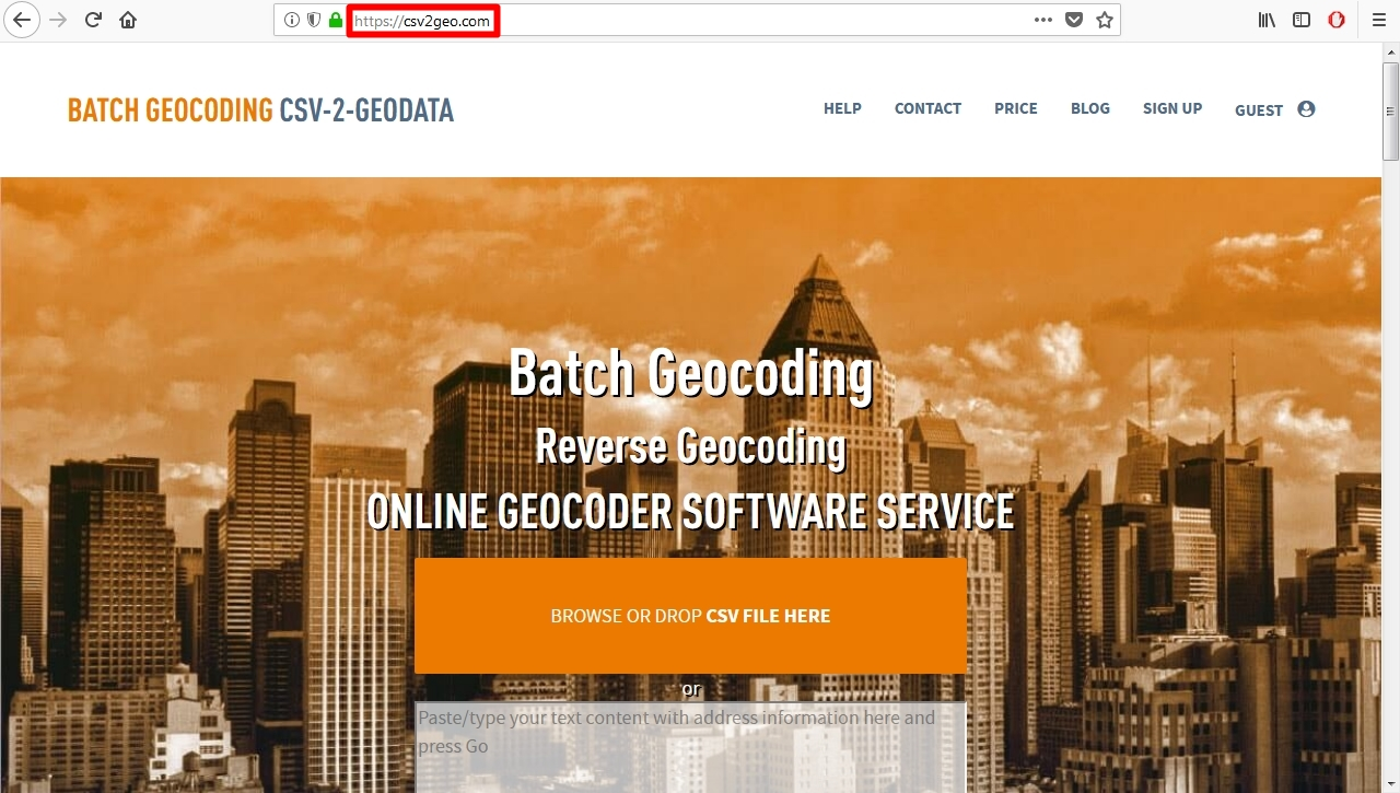
Step no. 1 – Search for the Batch Geocoding CSV-2-GEODATA website using this address: https://csv2geo.com/
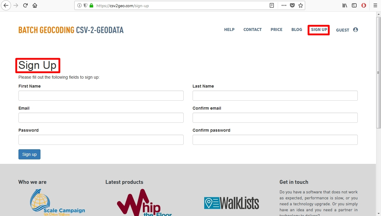
Step no. 2 – After you are on the first page of the website, you must sign up in order to be able to download the data that you convert.
Step no. 3 – In our example we utilize a data set downloaded from DATA.GOV website, using this link https://catalog.data.gov/dataset/fws-critical-habitat-for-threatened-and-endangered-species-dataset in order to download GIS shapefiles to obtain coordinates regarding different endangered species.
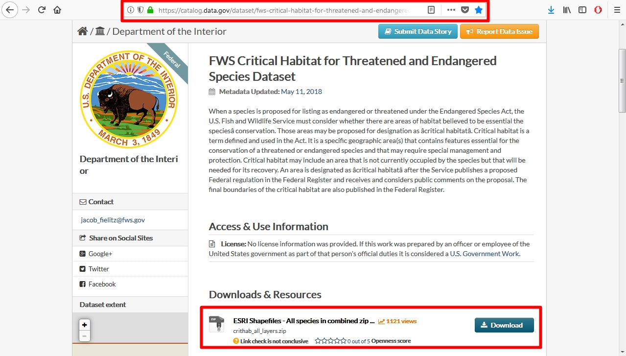
Step no. 4 – In our example we employ the file ‘FCH_Acanthomintha_Ilicifolia_20080826’, representing San Diego thornmint, which is a rare plant in the mint family. 28 rows were uploaded from a csv file into the website.
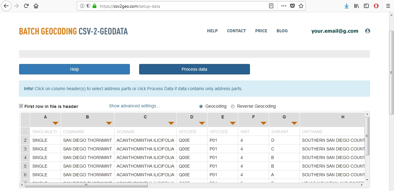
Step no. 5 – After those 28 rows were uploaded, we obtain the table and now we have to choose between ‘Geocoding’ and ‘Reverse geocoding’ option. Since we have postal address, we will choose ‘Geocoding’.
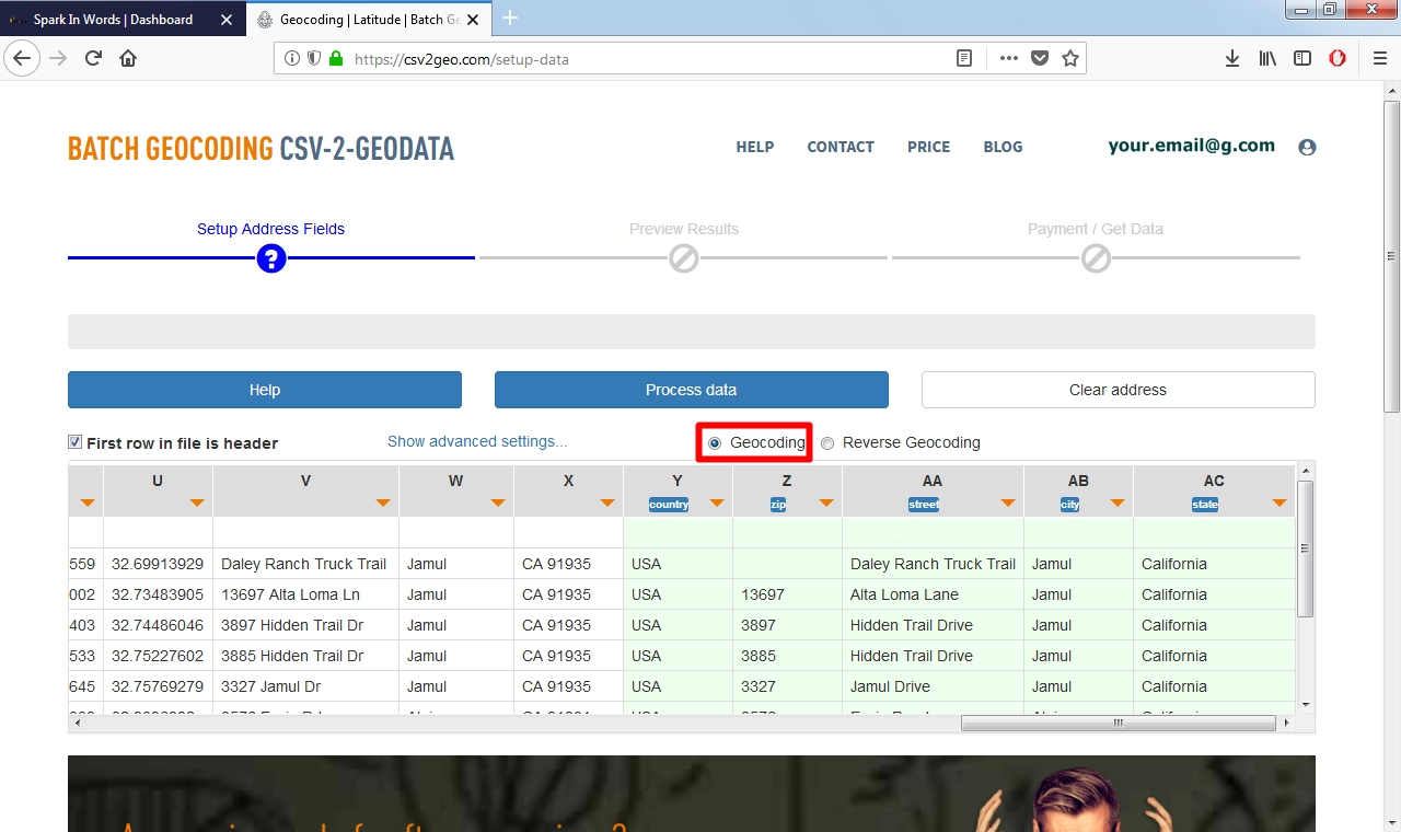
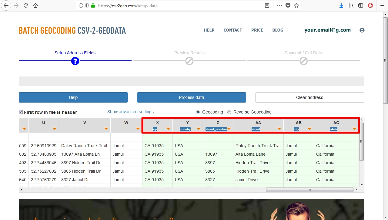
Step no. 6 – In the table we should choose the columns for city, state, country, zip, street name and street number.
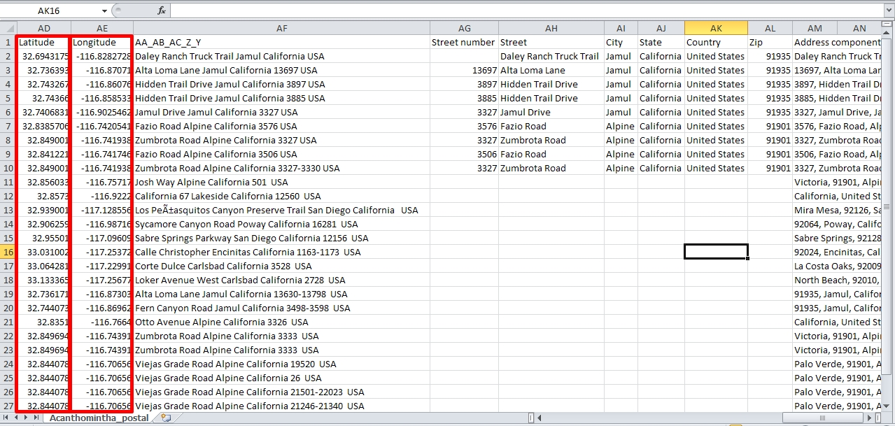
Step no. 7 – After that we obtain a preview of the data having the zip postal address on the left and the geographical coordinates on the right side.
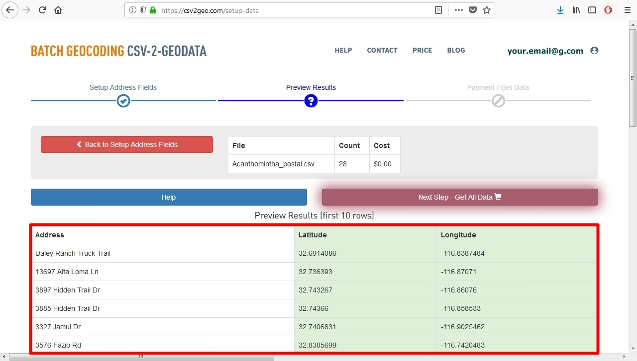
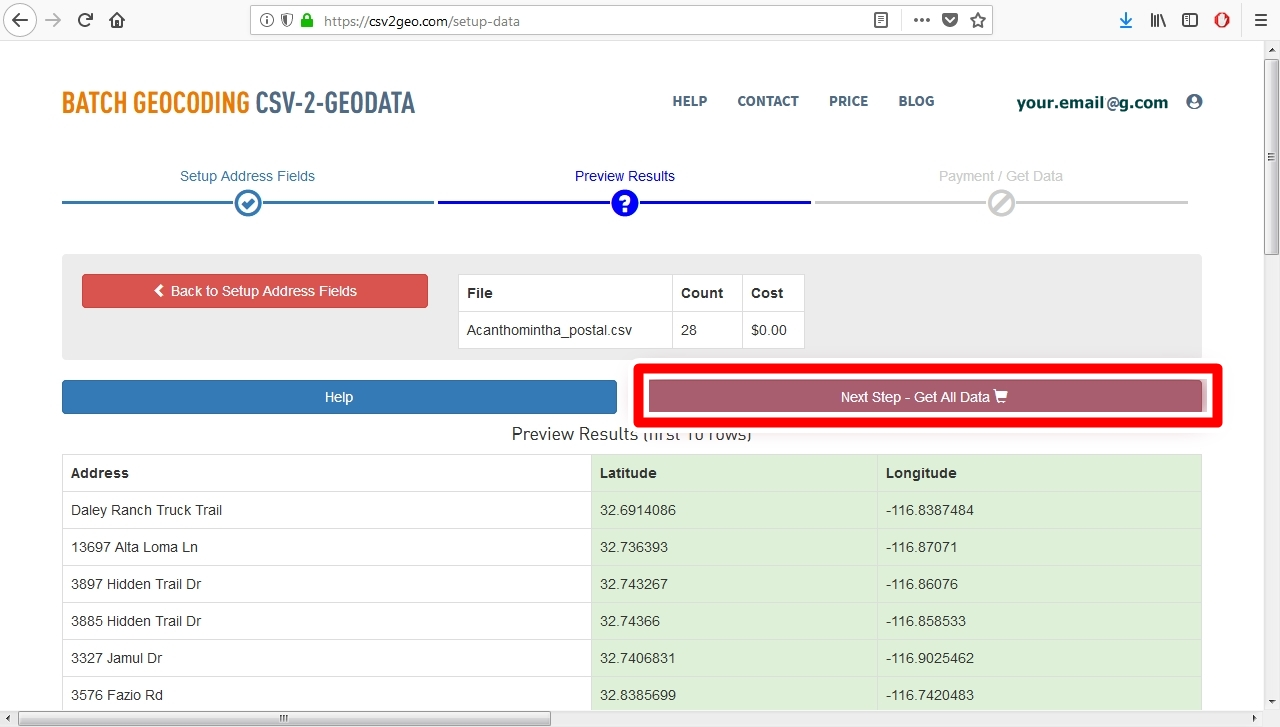
Step no. 8 – The next step is to obtain all the data.
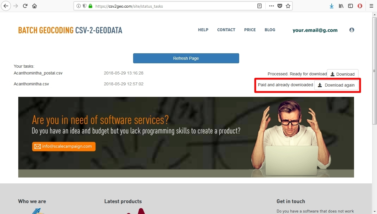
Step no. 9 – We obtain a page showing that the data haven’t not been yet processed, but after several minutes (depending on how many rows you upload), you can download the processed data using the ‘Download’ button since you notice a message on the right part of the page telling you that the data is ‘Ready for download’.


Step no. 10 – You will download the file as a csv file format and you will notice two columns representing latitude and longitude.
Step no. 11 – After you download the file, you can refresh the page and you will observe that the data have been paid and downloaded, but you can download the file again.
Step no. 12 – When you the reverse geocoding and geocoding processes are done, you can log out since you complete the conversion that you need

Conclude remarks
These are the steps if you choose to take advantage of csv2geo website for geocoding and reverse geocoding. The example with an endangered species in North America is among the numerous domains that may take advantage of our website. Plentiful other domains can utilize ScaleCampaign to transform geographical coordinates into zip postal code addresses or to transform postal addresses into geographical coordinates. Anyone can follow the guide-steps presented above in order to convert different types of data and obtain the data that they may need for their analysis or studies.